



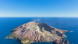
The Silent Threat on the Slopes
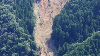
While explosive eruptions capture the headlines, one of the most consistent dangers from a volcano is the instability of its own structure. Heavy rain, melting snow, earthquakes, or the subtle bulging caused by magma moving underneath can trigger a landslide.
These are not minor events; they can be massive collapses involving millions of tonnes of rock and debris, travelling at high speeds and capable of burying entire communities. The challenge for scientists has always been monitoring these remote and hazardous slopes safely and effectively, especially in places where on-the-ground equipment is impractical or impossible to install.
An Eye in the Sky: How Satellites See
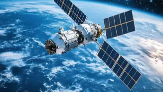
This is where satellite remote sensing has become a game-changer. Orbiting Earth, a fleet of sophisticated satellites operated by various space agencies provides a constant stream of data about our planet's surface. For volcanologists, these satellites are like remote doctors, taking the vital signs of a volcano without ever setting foot on it. They primarily use four types of observations: surface deformation, thermal anomalies (hot spots), gas emissions, and high-resolution optical images to track physical changes. This allows for continuous monitoring of even the most isolated volcanoes on Earth.
Radar Vision: Seeing the Ground Swell
Perhaps the most revolutionary tool is Interferometric Synthetic Aperture Radar, or InSAR. Unlike a regular camera, radar satellites can 'see' through clouds and operate day or night. An InSAR satellite sends radar pulses down to the ground and records the returning signal. By flying over the exact same spot at a later time and comparing the two radar images, scientists can detect minute changes in the ground's height. If magma is pushing up from below, the volcano's surface will bulge upwards by centimetres or even metres. InSAR can map this deformation across the entire volcano with incredible precision, creating colourful maps that show exactly where and how much the ground is moving. This swelling is often a direct precursor to an eruption or a landslide.
More Than Just Movement
Beyond tracking ground swelling, satellites provide other critical data. Optical satellites, which work like powerful digital cameras, can spot the development of new cracks, the paths of previous slides, or changes in vegetation that might signal unstable ground. Thermal sensors can detect increases in surface temperature, indicating that hot magma or volcanic gases are near the surface, which can weaken rock and contribute to instability. Other specialised sensors can even measure the types and amounts of gases like sulphur dioxide being released, which often increases before an eruption. By combining all these data sources—radar, optical, and thermal—scientists can build a comprehensive picture of a volcano's health and stability.
From Data to Early Warnings
This wealth of information is not just for academic study; it has real-world applications for saving lives. By identifying a volcano that is deforming rapidly, authorities can issue targeted warnings and plan evacuation routes. For example, satellite data was credited with helping inform the decision to evacuate hundreds of thousands of people near Indonesia's Merapi volcano, potentially saving thousands of lives. While the technology has limitations, such as the time between satellite passes, the ability to detect pre-failure deformation is a huge leap forward. Continuous monitoring allows scientists to create risk maps, highlighting which slopes are most vulnerable and helping communities avoid building in the most dangerous zones.