
A Hummingbird Emerges from the Ice
Scientists have nicknamed the image 'the hummingbird' for its uncanny resemblance to a bird in flight, with vast wings and a distinct body. This remarkable pattern isn't an ice sculpture, but rather a complex interplay between moving ice and solid rock.
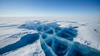
The 'body' of the bird is Nunatak Zaterjavshijsja, a rocky mountaintop that pokes through the vast ice sheet. As the surrounding glacier flows slowly toward the ocean, this immovable peak acts like a boulder in a river, causing the ice to stretch, bend, and fracture around it. The resulting network of deep cracks, or crevasses, forms the intricate 'feathers' of the hummingbird's wings, rendered in brilliant green lines by the satellite's advanced radar.
Meet NISAR, Earth’s New Watchdog
The eye in the sky responsible for this image is NISAR, which stands for NASA-ISRO Synthetic Aperture Radar. It is a powerful Earth-observing satellite born from a landmark collaboration between the US space agency, NASA, and the Indian Space Research Organisation (ISRO). Launched from India in July 2025, NISAR is on a three-year mission to scan nearly all of our planet's land and ice surfaces every 12 days. Unlike standard cameras that need light, NISAR uses radar to see. It bounces microwave signals off the Earth's surface and analyses the echoes that return, allowing it to see through clouds, darkness, and even vegetation. This makes it exceptionally good at its primary job: detecting tiny changes on the planet's surface, down to less than a centimetre.
The Science Behind the Colours
The vibrant colours in the hummingbird image are not just for show; they carry crucial scientific information. NISAR’s L-band radar sends out horizontally polarised signals. When these signals bounce off a smooth, flat surface like undisturbed ice, they return with the same horizontal orientation, which is coloured magenta in the image. However, when the signals hit irregular surfaces, like the sheer walls of a crevasse, they scatter in multiple directions and return with a vertical orientation. These areas are coloured green. The white and lighter-coloured areas show a mix of both types of reflections. This technique allows scientists to map the precise texture and structure of the ice, revealing hidden cracks and stresses that are invisible to the naked eye or optical satellites.
Why This Lonely Peak Matters
The anchor of this entire scene, the nunatak, is a key feature for polar scientists. The term 'nunatak' comes from an Inuit word for 'lonely peak,' and that’s precisely what it is: an island of rock in a sea of ice. These peaks serve as invaluable reference points. Since the nunatak is stationary, measuring the ice flowing around it helps scientists accurately gauge the speed and dynamics of glaciers. Furthermore, nunataks are isolated ecosystems, or refugia, that can host unique organisms like microbes and lichens that have survived in extreme conditions. They offer pristine natural laboratories for understanding polar geology and biology.
A Global Mission with Local Impact
While the hummingbird image is from one of the most remote places on Earth, the data NISAR collects has global significance, including for India. The mission's primary goals are to understand the effects of climate change, such as the collapse of ice sheets, and to better monitor natural hazards like earthquakes and landslides. The stability of Antarctica’s ice sheets is directly linked to global sea levels. As this ice melts, it contributes to rising seas that threaten coastal communities worldwide, including India's extensive coastline. By providing an unprecedented, detailed view of how and why ice is changing, the NASA-ISRO collaboration delivers vital information that helps scientists refine climate models and allows governments to make better-informed decisions to protect lives and infrastructure.