




A Disaster of Unprecedented Scale
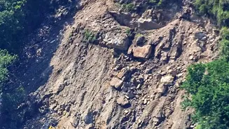
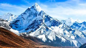
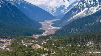
On August 26, 2026, a massive section of rock and glacier ice, spanning roughly two square kilometres, collapsed from the Langtang Lirung mountain near Nepal's border with Tibet. The debris plunged 1,400 metres, transforming into a torrent of water, ice, and sediment
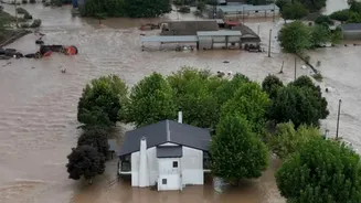
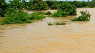
that travelled at over 170 kilometres per hour. The event was less a conventional flood and more a cascading disaster that overwhelmed entire communities along the Trishuli River corridor, leaving almost no time for warning. The deluge claimed over 1,300 lives, with more than 5,000 people remaining missing, and caused billions of dollars in damage, highlighting the extreme vulnerability of communities in the high mountains.
Connecting the Dots: The Science of Attribution
So how can scientists link a single event to long-term climate change? The answer lies in attribution science, a rapidly advancing field of climate research. The recent analysis was conducted by the World Weather Attribution group, an international team of scientists who specialise in this work. They analyze real-world observations and use computer models to compare the likelihood and intensity of an extreme event in today's warmer world versus a world without human-caused greenhouse gas emissions. For this disaster, it wasn't about a single weather event like rainfall. Instead, researchers looked at the long-term changes that made the mountain slope unstable over decades. They found that human-induced warming was a critical factor in 'preconditioning' the slope for failure.
The Sobering Verdict
The study concluded that there is “absolutely no doubt” that climate change played a role. Decades of warming have had multiple destabilising effects. Firstly, rising temperatures have pushed the freezing line—the altitude where water remains frozen—up the mountainside by about 100 metres per decade. This has exposed previously frozen ground, or permafrost, to thawing. This permafrost acts like a glue holding fractured rock together; as it thaws, the slope weakens. Secondly, the glaciers themselves are thinning and retreating, removing a crucial buttress that supports the steep rock faces. The glacier adjacent to the collapsed slope had retreated over 300 metres since 2010. Finally, warmer air means more rain is falling at high altitudes where it once would have been snow, with excess meltwater further destabilising the ground.
Not Just One Factor
While the fingerprints of climate change are clear, the scientists are careful to note it was not the sole cause. The powerful 7.8-magnitude earthquake that struck Nepal in 2015 may also have weakened the rock and created fractures deep within the mountain, though its exact contribution is difficult to quantify. The disaster is best understood as a compound event, where pre-existing geological vulnerabilities were significantly worsened by the long-term stresses of a warming planet. Exceptionally warm temperatures in July and August, which were about 1.5°C hotter due to climate change, combined with heavy snowfall in late 2025, likely provided the final push for the catastrophic failure.
A Warning for the Entire Himalayan Region
This disaster in Nepal is a grave warning for the entire Hindu Kush-Himalayan region, including India. The study highlights that the scale of the collapse was about five times that of the 2021 Chamoli disaster in Uttarakhand, indicating a terrifying increase in the magnitude of such events. The Himalayas are warming faster than the global average, putting millions of people who live downstream from the world's 'Third Pole' at increased risk. Experts warn that traditional early warning systems, which focus on rainfall-induced floods, are insufficient for these complex, cascading disasters. The event shows that limits to adaptation are already being reached, and there is an urgent need for integrated monitoring of glaciers, slopes, and rivers across the region.