

Seeing Through the Smoke
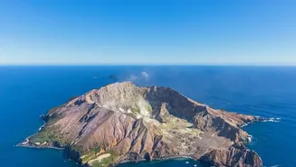
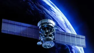
When a volcano erupts, visual confirmation can be obscured by weather clouds or the sheer scale of the event. This is where satellites equipped with thermal infrared sensors come in. These instruments can cut through the visual noise to detect the intense
heat of magma. By mapping temperature anomalies, scientists can track the path of a lava flow in near real-time, even at night or through dense cloud cover. This allows them to see exactly where hot lava is emerging and how quickly it is moving, which is critical information for emergency response teams tasked with protecting communities in the path of a flow.
A Watchful Eye on the Ground
Some of the most important clues a volcano gives happen long before an eruption. As magma moves and accumulates in chambers beneath the surface, it can cause the ground to swell and deform. This movement is often tiny, just millimetres or centimetres, and invisible to the naked eye. However, satellites using a technique called Interferometric Synthetic Aperture Radar (InSAR) can detect these subtle shifts. By comparing radar images taken at different times, scientists can create a 'deformation map' that shows exactly how the volcano is breathing. A sudden change in the rate of this swelling can be a key indicator that an eruption may be imminent.
Tracking Dangers in the Air
Volcanic ash is not like the soft ash from a fire; it consists of tiny, sharp particles of rock and glass. It poses a significant danger to aircraft, as it can melt in the heat of a jet engine and cause it to fail. Satellites are our primary tool for tracking these dangerous ash clouds. Instruments like the Ozone Mapping Profiler Suite (OMPS) can detect sulphur dioxide (SO₂), a gas commonly released with ash, helping to identify and map the three-dimensional structure of the plume. This allows aviation authorities to see the location, altitude, and trajectory of the ash cloud, ensuring that aeroplanes can be safely rerouted. The development of AI and machine learning algorithms is making this process even faster and more accurate.
Mapping a New World
After an eruption, the landscape can be changed forever. Mountains can collapse, new craters can form, and vast areas can be buried under lava and ash. Satellites are indispensable for mapping these changes. High-resolution optical images, essentially photographs from space, can be used to create detailed maps of the new topography. Radar satellites, which can 'see' through clouds, are crucial for observing the new landforms when visibility is poor. This information is vital for understanding the long-term impacts of an eruption, assessing new hazards like landslides, and planning for recovery and rebuilding.
The Unexpected Sentinels
In a fascinating blend of biology and technology, scientists have discovered that trees can act as volcanic early warning systems. As magma rises, it releases gases like carbon dioxide into the soil. This can act as a fertilizer, causing nearby vegetation to become unusually green and lush in the weeks or months before an eruption. This subtle 'greening' effect can be detected by Earth-observing satellites like Landsat and Sentinel. While not a replacement for traditional sensors, monitoring the health of plant life provides another valuable layer of data, especially for remote volcanoes in forested regions.