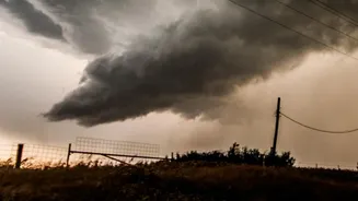








The Mystery of Warm Clouds
When we think of rain formation, we might imagine a complex process involving ice crystals high in the atmosphere. This is true for 'cold clouds', which are composed of a mixture of ice and super-cooled water. However, a significant amount of rainfall,
especially in tropical regions like India, comes from 'warm clouds'. These clouds are made up entirely of liquid water droplets, with temperatures remaining above freezing. The process here is different; instead of ice, rain forms through collision and coalescence, where tiny droplets bump into each other and merge, growing larger and heavier until they are big enough to fall. This seemingly simple process is surprisingly difficult for weather models to predict accurately.
A Fresh Look at Cloud Formation
Recent studies are forcing a rethink of how rainfall is simulated in climate models. A key issue has been that models often predict rain too readily from warm clouds, causing them to dissipate too quickly in simulations compared to what is observed in reality. This error has a domino effect, leading to underestimations of cloud lifespan and their overall cooling effect on the planet, as clouds reflect sunlight back into space. A study published in Nature Climate Change highlighted this discrepancy, using satellite data to recalibrate a model. The researchers found that when simulations were adjusted to better match real-world rainfall probability from warm clouds, the cooling effect of these clouds was significantly amplified.
The Role of Aerosols: A Complicating Factor
The plot thickens with the introduction of aerosols—tiny particles like dust, pollen, or pollution suspended in the atmosphere. These particles act as 'seeds' or condensation nuclei, around which water vapor condenses to form cloud droplets. Human activities have significantly increased the concentration of aerosols in the atmosphere. With more particles available, the same amount of water vapor forms a greater number of smaller droplets. These smaller droplets are less efficient at colliding and merging, which can suppress rainfall and make clouds last longer. Recent research has shown that this increase in cloud cover due to aerosols is a more significant factor in their cooling effect than previously thought, adding another layer of complexity that models must account for.
Why This Matters for India's Monsoon
For India, where the economy and agriculture are deeply tied to the monsoon, accurate rainfall prediction is not just an academic exercise. Because much of the monsoon rainfall originates from warm clouds, any improvement in modelling them has direct, real-world consequences. An inaccurate simulation of warm rain processes can lead to flawed forecasts, impacting everything from water resource management to disaster preparedness for floods and droughts. Furthermore, as air pollution contributes a high load of aerosols over the subcontinent, understanding the interplay between these particles and warm cloud physics is crucial for predicting how monsoon patterns might shift in a changing climate.
The Future of Weather and Climate Models
The new insights into warm cloud behaviour are part of a broader effort to refine our climate projections. Scientists are increasingly aware that simply increasing the resolution of models isn't enough; the fundamental physics of processes like cloud formation must be accurately represented. Studies have shown that some high-resolution models can even amplify errors if the underlying cloud physics are wrong. As a result, researchers are using observational data and even AI to better constrain these complex variables. This ongoing work is slowly chipping away at the largest uncertainties in climate science, promising more reliable predictions about our planet's future weather.