





A Fire That Makes Its Own Weather
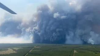
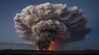
In late July 2026, a devastating wildfire raging near Bordeaux in the Gironde region of France became so intense that it created its own weather system. French officials and the national firefighters federation confirmed the formation of a pyrocumulonimbus
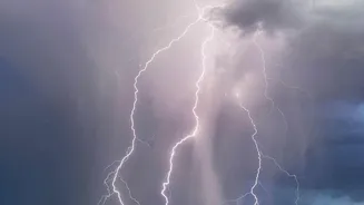
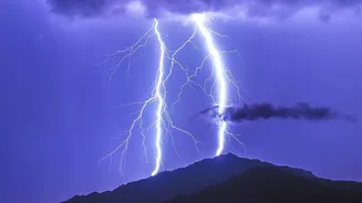
cloud, stating it was the first time such an event had been recorded in the country. The fire, which had already forced the evacuation of over 200,000 people and burned hundreds of square kilometres, escalated into a new dimension of danger. This 'firestorm' wasn't just being pushed by the wind; it was generating violent, erratic gusts and its own lightning, which in turn ignited new fires.
The Science of a Firestorm
So what exactly is a pyrocumulonimbus, or pyroCb? NASA has called it the “fire-breathing dragon of clouds.” It's what happens when the immense heat from a large, intense wildfire sends a superheated column of air, smoke, and moisture soaring into the atmosphere. As this plume rises to cooler altitudes, the moisture condenses, forming a massive, towering cloud akin to a regular thunderstorm. But this is no normal storm. The continuous updraft from the fire below fuels it, while collisions of ice particles inside the cloud generate electrical charges, resulting in lightning. The cloud also creates powerful downdrafts and unpredictable wind shifts, making the fire on the ground extremely dangerous and almost impossible to fight.
A Rare Spectacle in Europe
Pyrocumulonimbus events are exceptionally rare in Europe. The continent's climate and landscape have not historically provided the perfect storm of conditions required. These firestorms need more than just a large fire; they require a specific atmospheric setup, usually involving very hot, dry air near the surface with a layer of cooler, moister air above it. While Europe has always experienced wildfires, particularly in the Mediterranean, they have seldom reached the scale and intensity needed to punch through the atmosphere and generate their own thunderstorms. The recent event in France signals a worrying shift, suggesting that conditions are changing.
A Familiar Monster Elsewhere
While new to France, these fire-generated storms are a well-documented hazard in other global hotspots. Australia and North America, particularly California and western Canada, have seen numerous pyrocumulonimbus events. The infamous 'Black Summer' bushfires in Australia in 2019-2020 produced multiple firestorms that sent smoke into the stratosphere and carried embers over vast distances. Similarly, devastating fires in California and Canada have generated these extreme weather systems, complicating firefighting efforts and demonstrating their immense destructive potential. These regions share a climate profile characterised by vast tracts of forest, intense heat, and prolonged droughts—conditions that are becoming more prevalent elsewhere.
A Sign of a Changing Climate
The appearance of a pyrocumulonimbus cloud in France is more than a meteorological curiosity; it is a stark indicator of a changing climate. Scientists have warned that rising global temperatures are creating hotter, drier conditions across Europe, turning landscapes into tinderboxes. As heatwaves become more frequent and severe, the likelihood of 'megafires' capable of producing their own weather increases. Experts believe the probability of having the right fire intensity and atmospheric instability occur at the same time is rising. What was once a phenomenon confined to specific parts of the world could become a dangerous new reality for Europe, posing unprecedented challenges for communities and firefighters.