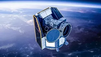








A Sky Crowded with Private Eyes
Forget the era when space was the exclusive domain of national governments. Today, companies like Planet Labs, Maxar, and ICEYE operate vast constellations of satellites. Unlike their bulky government predecessors, many of these are small, agile, and numerous,
capturing images of the entire Earth's surface with astonishing frequency. This isn't just about taking pictures; it's about creating a living, breathing, and constantly updated digital twin of our planet. These companies use technologies like Synthetic Aperture Radar (SAR), which can see through clouds and at night, providing a relentless stream of data. This surge in private activity is creating a multi-billion dollar Earth observation market, fundamentally changing who has access to a god's-eye view of the world.
The AI Brain That Understands It All
The sheer volume of data beamed down from these satellites is far too much for humans to analyze manually. This is where artificial intelligence comes in. AI and computer vision algorithms sift through petabytes of imagery to detect patterns, track changes, and extract insights at a scale and speed that was previously unimaginable. These systems can automatically count cars in a parking lot to gauge retail activity, monitor the health of every crop in a region, track deforestation in near real-time, or detect ships engaging in illicit activities. By comparing new images against a historical baseline, AI can spot subtle changes that a human eye would easily miss, transforming raw data into actionable intelligence.
Solving Problems for Planet and Profit
The combination of private satellites and AI offers tremendous benefits. For agriculture, it enables precision farming, where farmers can optimize irrigation and fertilization, boosting crop yields while conserving resources. In the fight against climate change, this technology provides crucial data for monitoring deforestation, tracking glacier melt, and assessing the impact of natural disasters. Insurance companies and banks use this data to assess risks from floods or droughts more accurately and speed up claims. For humanitarian organizations, it offers a way to monitor human rights abuses or coordinate disaster response in remote areas. This technology is not just creating business opportunities but is also becoming a critical tool for global sustainability and security.
An Unregulated Wild West
This rapid expansion is happening in a legal and ethical grey area. The primary international agreement, the 1967 Outer Space Treaty, was written when space was the domain of superpowers, not private corporations. It offers little specific guidance on issues like data privacy, surveillance, and national sovereignty in the age of commercial Earth observation. This raises thorny questions: Who owns the data captured over a country's sovereign territory? What prevents this powerful surveillance technology from being used for corporate espionage or monitoring civilian populations? While some nations have licensing requirements, there is no binding global framework, creating a 'Wild West' scenario where rules vary dramatically from one country to another.
Congestion, Debris, and a Crowded Future
Beyond data governance, there are physical risks. The orbits around Earth, particularly low-Earth orbit (LEO), are becoming dangerously crowded. The explosion in satellite numbers dramatically increases the risk of collisions. A single collision can create thousands of pieces of space debris, each traveling at immense speeds. This debris can stay in orbit for decades, threatening other satellites and future launches in a chain reaction known as the Kessler Syndrome. While companies are developing mitigation strategies, the sheer number of planned satellite launches—with some proposing constellations of tens of thousands—presents a long-term threat to the sustainability of space activities.