
What's Happening?
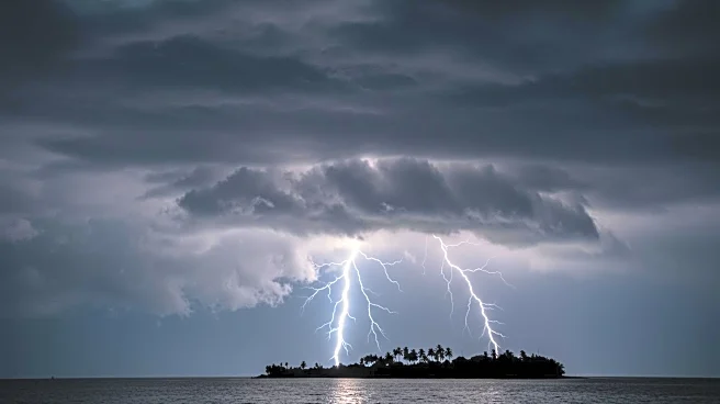
Hurricane Erin has rapidly intensified into a Category 5 storm as it moves through the north-east Caribbean. The National Hurricane Center (NHC) has described Erin as 'catastrophic,' with maximum sustained winds reaching 160 mph. The storm is currently located 105 miles north-east of Anguilla and is moving west at 17 mph. Although Erin is not expected to make landfall in the U.S., it poses a significant threat to nearby islands, with forecasts predicting heavy rain and strong winds that could lead to flooding and landslides. Tropical storm watches are in effect for several northern Leeward Islands, including St Martin, St Barts, Anguilla, and Barbuda. The storm's outer bands are already affecting these areas, with more rain expected over the weekend.
Why It's Important?
The intensification of Hurricane Erin highlights the increasing frequency of rapid storm development, a phenomenon linked to rising global temperatures. This storm is the first major hurricane of the 2025 Atlantic season, underscoring the potential for severe weather events as ocean temperatures continue to rise. The U.S. government has taken precautionary measures by deploying over 200 FEMA employees to Puerto Rico, a U.S. territory, and issuing flood watches. The potential impact on the Caribbean islands includes significant disruptions due to flooding and rough ocean conditions, which could affect local economies and infrastructure. The storm's progression is being closely monitored by officials in the Bahamas, who have prepared public shelters as a precaution.
What's Next?
As Hurricane Erin continues to move through the Caribbean, its size is expected to increase, potentially doubling or tripling by mid-next week. This expansion could result in rough ocean conditions over the western Atlantic, affecting areas such as the Bahamas, Bermuda, and the U.S. East Coast. The NHC warns of life-threatening rip currents and rough seas, urging residents and authorities in affected regions to remain vigilant. The U.S. Coast Guard has closed several seaports in Puerto Rico and the U.S. Virgin Islands to incoming vessels, unless authorized, to mitigate risks. Continued monitoring and preparedness efforts are crucial as the storm progresses.
Beyond the Headlines
The rapid intensification of Hurricane Erin serves as a stark reminder of the broader implications of climate change on weather patterns. As global temperatures rise, the likelihood of severe and unpredictable storms increases, posing challenges for disaster preparedness and response. The deployment of FEMA personnel and the inspection of shelters in Puerto Rico reflect the proactive measures necessary to safeguard vulnerable populations. Additionally, the closure of seaports highlights the economic impact of such storms, affecting trade and transportation in the region.