

/images/ppid_a911dc6a-image-177774803200887545.webp)

The India Meteorological Department (IMD) has issued a two-day yellow alert for Delhi, warning of rain and thunderstorms over the next couple of days. The alert indicates possible weather disturbances, including lightning and gusty winds, across the national capital.
According to the forecast, Delhi is likely to witness light rain accompanied by thunderstorms and winds reaching speeds of 30–40 kmph, with gusts up to 50 kmph. These conditions are expected to continue over Sunday and may persist into Monday.
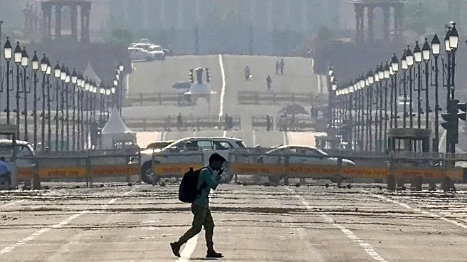
The weather change is expected to bring relief from heatwave-like conditions, with no heatwave likely in the coming days. Temperatures are also expected to remain moderate, even as the city continues to experience fluctuating weather patterns.
On Saturday, the minimum temperature recorded at Safdarjung, the city’s representative weather station, was 25.9 degrees Celsius, which is a 3.1-degree increase from the previous day and 1.2 degrees above normal.
The maximum temperature reached 38.6 degrees Celsius, which is 0.7 degrees below normal but 2.2 degrees higher than the day before.
Other weather stations also recorded a similar rise in maximum and minimum temperature, though the maximum temperature remained below the normal.
Palam recorded a maximum of 38 degrees Celsius, which is 2.9 degrees higher than the day prior and 2.1 degrees below normal. Its minimum temperature was logged at 23.6 degrees Celsius, 2.3 degrees higher than on Friday.
Lodhi Road reported a minimum of 24.8 degrees Celsius, a rise of three degrees from the previous day, while Ridge noted a 3.3-degree increase, and Ayanagar had a 4.2-degree rise, with minimum temperatures at Ridge and Ayanagar being 23.7 degrees Celsius and 25.6 degrees Celsius, respectively.
According to IMD, the maximum temperature is expected to be around 36-38 degrees Celsius on Sunday, while the minimum temperature is likely to be around 26-28 degrees.
“An IMD official stated, “A spell of very light to light rain, accompanied by thunderstorms, lightning, and strong winds of 30-40 km/h, gusting up to 50 km/h, is likely to occur on Sunday.” Similar conditions may persist into Monday.
Mahesh Palawat, vice president of Skymet, said, ” A fresh western disturbance is expected to influence the region in the coming days, leading to a cyclonic circulation over adjoining areas. Light rain might occur in parts of the city for the next few days, and there is no possibility of a heatwave at least for the next week.”
Meanwhile, the city’s air quality remained in the moderate category. The 24-hour average Air Quality Index (AQI) was recorded at 144 (moderate) at 4 pm on Saturday, compared to an AQI of 120 at the same time on Friday, according to data from the Central Pollution Control Board (CPCB).
According to CPCB standards, an AQI of 0-50 is considered ‘good’, 51-100 ‘satisfactory’, 101-200 ‘moderate’, 201-300 ‘poor’, 301-400 ‘very poor’, and 401-500 ‘severe’.
The Air Quality Early Warning System (AQEWS) for Delhi has forecast the AQI to remain in the moderate category for the next few days.
(With inputs from PTI)

/images/ppid_a911dc6a-image-177775526164164539.webp)

/images/ppid_a911dc6a-image-177775523083983829.webp)


/images/ppid_a911dc6a-image-177775503954945231.webp)

/images/ppid_a911dc6a-image-177775156579023113.webp)
/images/ppid_a911dc6a-image-177775153334311566.webp)