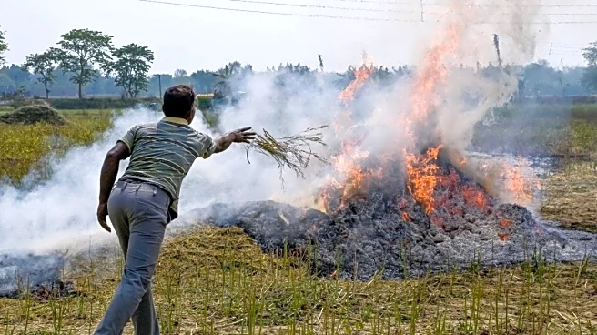

Days after a research study by Space Application Centre (SAC) flagged underestimation of farm fires in satellite data, a new report has called for more rigorous monitoring by adding burnt area data to the
active farm fire counts.
The latest report led by New Delhi-based International Forum for Environment, Sustainability and Technology (iFOREST) analysed the MODIS and VIIRS data from the polar-orbiting satellites Terra, Aqua and Suomi-NPP, along with Sentinel-2 MSI burnt-area maps, and 15-minute SEVIRI observations from geostationary on Meteosat 8 and 9. It found that over 90 per cent of the large fires in Punjab in 2024 and 2025 occurred after 3pm, compared to just 3 per cent in 2021. Similarly, in Haryana, most large fires occurred after 3pm since 2019. This follows the findings of a previous study published by Space Application Centre (SAC), ISRO, which had indicated a shift in the peak fire activity from 1.30pm in 2020 to 5pm in 2024.
Researchers say since the current monitoring relies primarily on polar-orbiting satellites (MODIS/VIIRS) that pass over India between 10.30am and 1.30pm, it misses the majority of large farm fires, which now occur later in the afternoon and evening. So, the government data suggesting a dramatic 90 per cent reduction in farm fires in Punjab and Haryana since 2022 is also a result of limitations in the current monitoring system, the report said.
“Our analysis provides incontrovertible evidence that India’s current stubble-burning monitoring system is structurally mis-aligned with ground realities. We urgently need to overhaul the system,” said Chandra Bhushan, CEO, iFOREST.
INCLUDE TOTAL BURNT AREA TOO
The current monitoring system for stubble burning in North India is led by the Consortium for Research on Agroecosystem Monitoring and Modelling from Space (CREAMS) of the Indian Agricultural Research Institute (IARI), which uses data from MODIS and VIIRS sensors from the polar-orbiting satellites Terra, Aqua and Suomi-NPP to estimate the total fire counts in six states—Punjab, Haryana, Uttar Pradesh, Delhi, Rajasthan and Madhya Pradesh.
According to it, the farm fire counts fell by 93.8 per cent in Punjab, and by 84.3 per cent in Haryana since 2020. While experts acknowledge a decline in incidents, they say, the drop is far lower than satellite data suggests. iFOREST’s burnt-area analysis by Sentinel-2 satellite revealed that burnt area during the Kharif season in Punjab reduced from a peak of 31,447 km² in 2022 to about 20,000 km² in 2025—a 37 per cent reduction. Similarly, in Haryana, burnt area was reduced from a peak of 11,633 km² in 2019 to 8,812 km² in 2025—a 25 per cent reduction, although without a consistent downward trend.
With data gaps are weakening the evidence base for air-quality policymaking, the report called for immediate corrective measures, including revised monitoring protocols, which includes publishing burnt-area data, not just active fire counts to provide an accurate national picture. “Burnt area provides a more reliable picture of stubble burning. Our analysis shows that Punjab and Haryana have reduced burnt area by 25-35 per cent, which is good news and indicates that in-situ and ex-situ stubble-management practices are being adopted. But this is not the time to become complacent, as the extent of burnt area is still high,” added Chandra Bhushan, CEO, iFOREST.
UP, MP EMERGING AS NEW HOTSPOTS
The report also raises concerns over increase in farm fires in Uttar Pradesh and Madhya Pradesh which have emerged as new hotspots in recent years. This season, a total of 33,028 fire counts were detected using satellite remote sensing in the six states, with Madhya Pradesh (17,067) and Uttar Pradesh (7,290) leading the count, followed by Punjab (5,114), Rajasthan (2,890), Haryana (662) and Delhi (5).
“We cannot manage what we do not measure accurately. Policy decisions are currently being shaped by incomplete information. To solve the stubble-burning problem in the Indo-Gangetic Plain, the government must urgently reform the monitoring protocol to integrate burnt-area mapping and geostationary data. We also need to expand our focus beyond Punjab and Haryana to emerging hotspots in Uttar Pradesh and Madhya Pradesh,” said Ishaan Kochhar, Programme Lead, iFOREST.


/images/ppid_a911dc6a-image-177084603066450478.webp)


/images/ppid_a911dc6a-image-177084257810510483.webp)
/images/ppid_a911dc6a-image-177084253417916956.webp)

/images/ppid_59c68470-image-177084004043125742.webp)

/images/ppid_a911dc6a-image-177083903258342419.webp)