
/images/ppid_59c68470-image-177088261751149179.webp)

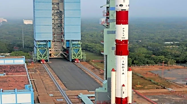
The Indian Space Research Organisation (ISRO) is ready to begin the new year with the launch of an advanced Earth observation satellite aboard its workhorse—the PSLV.
The launch of the mission, PSLV C62-/EOS N1, is scheduled at 10.17 am on January 12 from its spaceport at Sriharikota. EOS-N1 is a hyperspectral imaging satellite capable of capturing ground data in hundreds of narrow wavelength bands, which can help in the identification of materials on the ground, not just shapes and colours.
It will be accompanied by 18 other co-passenger satellites from different Indian and international users through its industrial partner NewSpace India Limited (NSIL). NSIL has been marketing ISRO’s launch services onboard PSLV, SSLV, and LVM3 launchers to
international customers. To date, it has launched a total of over 137 customer satellites onboard 5 PSLV, 2 LVM3, and 2 SSLV missions.
ISRO has a packed launch calendar this year, beginning with the first uncrewed mission of Gaganyaan to demonstrate an end-to-end mission, including the aerodynamics of the human-rated launch vehicle, mission operations of the orbital module, re-entry, as well as recovery of the crew module. This will be followed by a Technology Demonstration Satellite (TDS-01) to validate new technologies and indigenous components for satellite platforms. Once proven, these technologies will be employed in navigation and communication missions in the near future.
The anticipation is also building for the launch of the first fully Indian-industry-manufactured PSLV through NSIL, which is also working to build five PSLV-XL through Hindustan Aeronautics Limited (HAL) and L&T Consortium.
The industry-made PSLV will launch an Earth Observation Satellite for oceanographic studies along with the Indo-Mauritius joint satellite and Leap-2 satellite. The Oceansat-3A (EOS-10) is meant for meteorological, oceanographic, and land applications. It has an Ocean Colour Monitor (OCM), Sea Surface Temperature Monitor, and Millimetre-wave Atmospheric Temperature and Humidity Sounder as payloads to provide daily data for various applications. The data products from these instruments will support in Potential Fishing Zone identification, coastal zone management, ocean dynamics, numerical weather prediction models, tropical cyclone monitoring and forecasting, and various land and atmospheric applications.
/images/ppid_59c68470-image-177087759367465250.webp)

/images/ppid_59c68470-image-177096510334513942.webp)
/images/ppid_59c68470-image-177095515658937155.webp)

/images/ppid_59c68470-image-177088005593010534.webp)
/images/ppid_59c68470-image-177086765360591863.webp)
/images/ppid_59c68470-image-177087512498797308.webp)
/images/ppid_59c68470-image-177095259574929498.webp)
/images/ppid_59c68470-image-17709502481006608.webp)