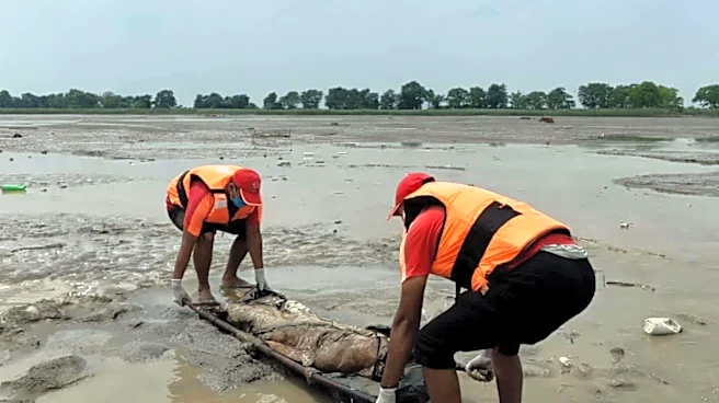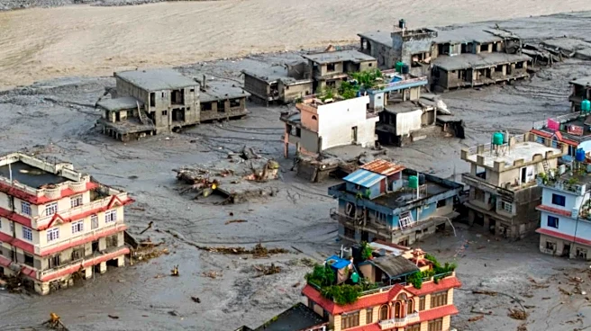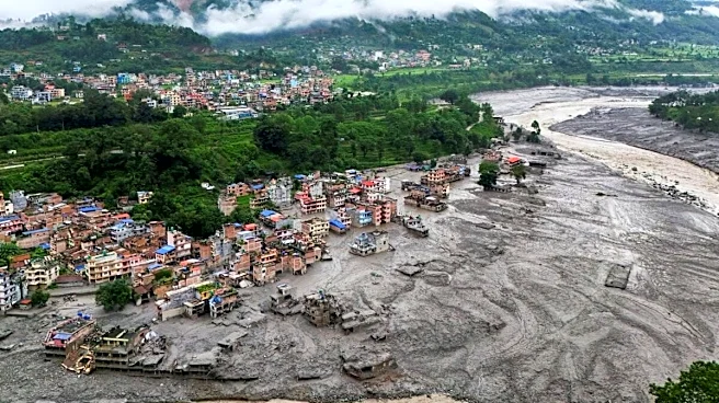

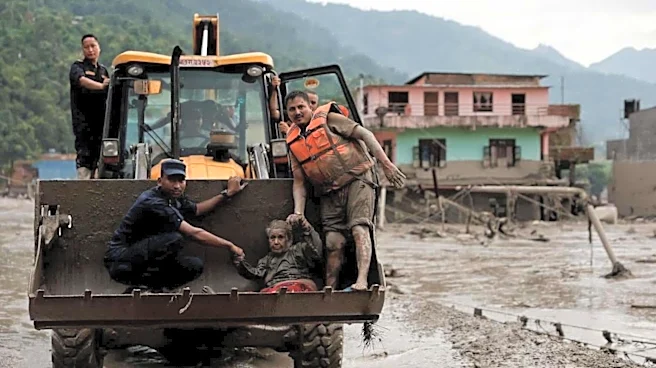
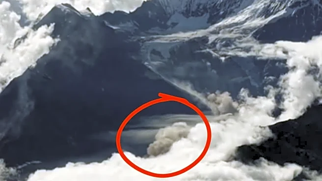
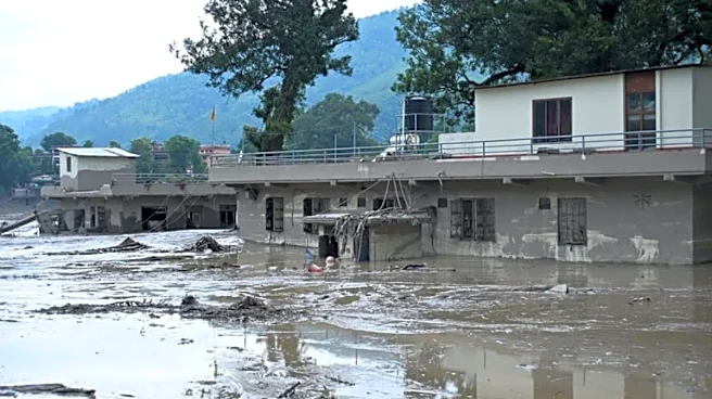
The devastating flash flood that swept through Nepal’s Rasuwa district and the Nepal-Tibet border region on Wednesday was triggered by a dramatic glacier collapse, with nearly two-thirds of a high-altitude glacier shearing away and plunging about 1.2 km into the Lhende Khola river catchment.
Satellite imagery and scientific assessments have now helped reconstruct the chain of events that turned the glacier collapse into a powerful debris-laden torrent, devastating the Bhote Koshi-Trishuli corridor.
Satellite images analysed by ISRO’s National Remote Sensing Centre showed that almost two-thirds of the glacier had detached. An August 24 Sentinel-2 image showed the glacier intact, while a Landsat-9 image taken after the disaster on August 26 showed a large
scar marking the zone where the glacier had broken away.
The Trigger
The sequence began at an altitude of around 5,200 metres, where a large section of the glacier broke away.
ALSO READ | Fresh Flooding In Next 3 Days? Nepal, China Warn As Debris-Blocked Lake Threatens To Burst
Geomorphologist Daniel Shugar of the University of Calgary estimated, using Planet Labs imagery, that roughly 200 square metres of ice broke off and then plunged about 1.2 km vertically to the valley floor, a Times of India report said.
The enormous vertical drop converted gravitational energy into motion, causing the falling ice to fragment and sweep up loose material rather than remaining as a single block. As the mass descended, it grew rapidly.
Scientists said the collapsing glacier picked up rocks, snow, sediment, trees and other debris, transforming what began as an ice collapse into a much larger debris flow.
Simon Cox, principal scientist at Earth Sciences New Zealand, described the process as the glacier collapse transforming into “a very large debris flow”, according to TOI.
‘Liquid Concrete’
The huge quantity of material carried downstream fundamentally changed the character of the flood. Instead of behaving like ordinary floodwater, the mixture contained such a high concentration of mud, rocks, ice and debris that it became extremely dense and destructive.
ALSO READ | Nepal Flash Flood: Before And After Images Show Rasuwagadhi Border Crossing Wiped Out
Hydrologist Hatim Sharif of the University of Texas at San Antonio described such fast-moving mud-and-water flows as being “like liquid concrete”, because they can sweep away vehicles, buildings and even large boulders rather than simply flowing around them.
The collapse was also powerful enough to register on seismic instruments.
What Did Satellite Images Reveal?
The satellite imagery provided a before-and-after picture of the glacier.
ALSO READ | Kailash Mansarovar Yatra Explained: Why Missing Indians Were Travelling Through Nepal
The August 24 Sentinel-2 image showed the glacier before the collapse. Two days later, a Landsat-9 image revealed a large scar where the glacier had broken away. The imagery also traced the path of the resulting ice-and-rock avalanche towards the river.
The collapse occurred on the Nepalese side of the Nepal-Tibet border, before the resulting debris and floodwater moved into the river system below.
Why Was The Flood So Destructive?
The key was the chain reaction.
ALSO READ | Did China’s Inaction Worsen Nepal Flash Flood Impact? Here’s What Geostrategist Brahma Chellaney Says
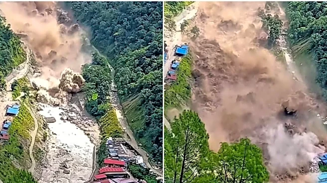
As the glacier broke, ice plunged about 1.2 kilometres. It then picked up rocks and sediment and the debris temporarily blocked the river. Ultimately, the natural blockage gave way and huge debris-laden torrent raced downstream.
The combination of water, ice, rock, mud, snow and other material gave the flood enormous destructive power.
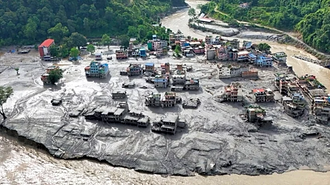
That helps explain how the disaster was able to uproot infrastructure and settlements along the Bhote Koshi-Trishuli corridor within a very short period.
The reconstruction of the event is significant because the disaster was initially associated with seismic activity and a possible earthquake-triggered event.
ALSO READ | From Gandak To Kosi, Bagmati & Ghaghara: How Floods In Nepal Put Bihar And Uttar Pradesh At Risk
The latest satellite and scientific assessment points to a glacier collapse as the critical trigger, with the resulting avalanche and debris flow producing the catastrophic flooding. It also brings the spotlight on the growing concern around instability in the high Himalayas, where rapidly changing glacial and mountain conditions can create cascading hazards.
The Nepal disaster therefore was not simply a case of a river overflowing. It was a chain reaction that began more than five kilometres above sea level, when a huge section of glacier broke away and plunged more than a kilometre down the mountainside, transforming ice into an avalanche, the avalanche into a debris flow, and the debris flow into what scientists described as a “liquid concrete” flood.
/images/ppid_59c68470-image-178791253661980644.webp)

/images/ppid_59c68470-image-178790264095773549.webp)
/images/ppid_59c68470-image-178784756369978004.webp)
/images/ppid_59c68470-image-178788510516545800.webp)