



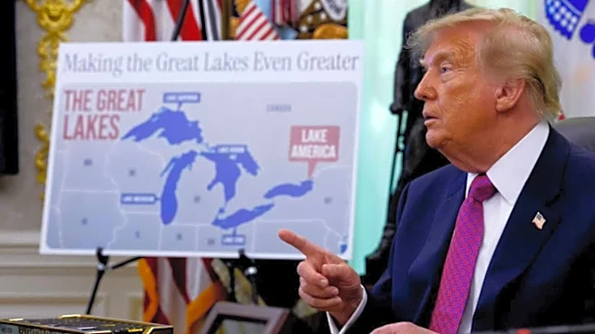
Google Maps has introduced another controversial geographical name change in the United States, with Lake Ontario now appearing as “Lake America” for users browsing the service from within the US. The change follows an executive order issued by the US administration and is based on an update to the country’s official geographic naming database.
The latest move comes months after Google Maps changed the name of the Gulf of Mexico to “Gulf of America” for users in the US. Google has again followed its policy of reflecting geographical names used by official government sources, while displaying different names depending on the user’s location.
Why Google Maps Is Showing ‘Lake America’ In The US
Google says the name displayed on Maps is determined partly by official geographic databases maintained
by individual countries. In the US, the relevant source is the US Geographic Names Information System (GNIS).
Following the latest government decision, GNIS has reportedly updated its records to identify Lake Ontario as “Lake America” within the United States. Google Maps is now beginning to reflect that change for people accessing the service from the country.
Google explained that this approach is consistent with its existing policy for geographical features whose names differ between countries. Rather than forcing a single name worldwide, Maps can show different labels based on the user’s location.
As a result, the lake will not necessarily have the same name for everyone using Google Maps. Users in the US will see Lake America, while people accessing Maps from Canada will continue to see Lake Ontario. Users elsewhere in the world are expected to see both names.
Google Maps Will Show Different Names Depending On Location
The latest update highlights how Google Maps handles disputed or internationally different geographical names. The company says it relies on authoritative government sources when deciding which local naming convention to display.
Google used a similar approach when it changed the Gulf of Mexico’s label earlier. Following a US government naming decision, users in the US began seeing “Gulf of America”, while users in Mexico continued to see “Gulf of Mexico”. In other regions, Google Maps displayed both names.
The company has said that these location-based naming practices are not new and are intended to account for differences in official geographical terminology between countries.
Canada Plans To Keep The Name Lake Ontario
The change has also drawn attention in Canada, where officials have indicated that the traditional name Lake Ontario will remain in use.
Canadian Prime Minister Mark Carney defended the historic name, pointing to its long-standing origins and cultural significance. The name Lake Ontario dates back more than four centuries and predates both the creation of the Canadian federation and the independence of the United States.
The word “Ontario” is generally linked to the Wendat term Ontari’io, which has been interpreted as referring to a large or beautiful lake.
Canadian authorities therefore have no plans to replace the traditional name in their official records and mapping systems simply because the US has adopted a different designation.
What Other Mapping Services Are Doing
Google is not the only mapping platform facing questions over the naming change. Reports indicate that MapQuest has decided not to follow the US naming update.
Instead, the service has reportedly introduced an interactive feature that allows users to create their own alternative names for the lake. This gives users a way to engage with the controversy without officially replacing the established geographical name.
Apple Maps, meanwhile, has reportedly not yet adopted “Lake America” as its US label. Apple previously moved relatively quickly when the Gulf of Mexico was renamed “Gulf of America” in Google’s mapping service, with the change reportedly appearing on Apple Maps shortly afterwards.
Whether Apple ultimately adopts the latest terminology for Lake Ontario remains to be seen.
Why Google Uses Different Geographical Names
Google’s explanation is largely based on its approach to international geographical naming. A body of water can have different official names in different countries, and mapping platforms have to decide how those differences should be represented.
For Google Maps, the location of the person viewing the map can therefore determine which name is given prominence. This means a user in the US could see “Lake America”, while someone standing on the Canadian side of the lake could continue to see “Lake Ontario”.
People outside both countries may see both names, providing additional context where there is a difference between the two countries’ official naming conventions.
The Lake Ontario change is consequently less about Google independently renaming the lake and more about the company updating its US-facing Maps data to reflect a change made by an official American geographic authority.
/images/ppid_59c68470-image-178807752977088237.webp)

/images/ppid_59c68470-image-178814264663051598.webp)
/images/ppid_59c68470-image-178814268186962140.webp)
/images/ppid_59c68470-image-178814254716628427.webp)



/images/ppid_59c68470-image-178803752825461396.webp)
/images/ppid_59c68470-image-178790755915260093.webp)