


The southwest monsoon has gathered pace after a delayed onset over Kerala, advancing into Maharashtra on schedule and triggering heavy rainfall warnings across parts of Tamil Nadu as weather authorities forecast further progress over the coming days.
According to the India Meteorological Department (IMD), the monsoon entered Maharashtra on June 6, just two days after making landfall in Kerala. While the seasonal rains arrived in Kerala on June 4—three days later than the normal onset date—they have since advanced rapidly along the western coast.
The weather department said the monsoon has now covered the entire Goa region and expanded into parts of Maharashtra, Karnataka, Andhra Pradesh, Tamil Nadu, the Arabian Sea, the Bay of Bengal and northeastern
states including Mizoram and Manipur.
Monsoon Progress Across India
The IMD’s latest update indicates that the Northern Limit of Monsoon currently passes through Devgad in Maharashtra’s Konkan region, Koppal in Karnataka, Anantapuramu in Andhra Pradesh and Chennai in Tamil Nadu.
Meteorologists expect the monsoon to continue its advance over the next two to three days, potentially covering larger parts of Maharashtra, Karnataka and Andhra Pradesh, while extending into Telangana and the remaining regions of Tamil Nadu.
The swift progression has eased concerns that emerged following the delayed onset over Kerala and is expected to support the upcoming kharif sowing season in several agricultural states.
Maharashtra Welcomes Timely Arrival
For Maharashtra, the monsoon’s arrival has come largely in line with its normal schedule despite the delayed onset in Kerala. The rains are expected to bring relief from intense summer temperatures and improve soil moisture conditions ahead of the agricultural season.
Farmers across rain-dependent regions will be closely monitoring rainfall distribution in the coming weeks as sowing activities begin.
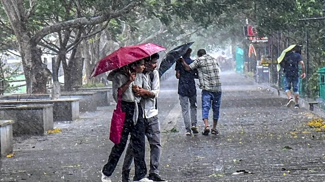
Tamil Nadu Braces for Heavy Rainfall
While the monsoon advances, Tamil Nadu is preparing for a significant increase in rainfall activity.
The Regional Meteorological Centre (RMC) has issued warnings for heavy to very heavy rainfall across several districts, particularly along the Western Ghats. Thunderstorms accompanied by lightning and gusty winds of up to 50 kmph are also expected.
The Nilgiris, Theni and Dindigul districts, along with the ghat areas of Coimbatore, are likely to witness the most intense rainfall episodes. Authorities have warned that isolated locations in these regions could receive very heavy downpours capable of triggering localised flooding and landslides.
Heavy rainfall has also been forecast for Erode, Salem, Dharmapuri, Krishnagiri, Tirupattur, Vellore, Ranipet, Tiruppur, Madurai, Virudhunagar and Kanyakumari districts, as well as the hill regions of Tenkasi and Tirunelveli.
Rainfall Already Intensifying
Early signs of strengthening monsoon conditions are already visible in southern Tamil Nadu.
Nalumukku in Tirunelveli district recorded 17 cm of rainfall during the past 24 hours, the highest in the state, while Mylar in Kanyakumari district received 9 cm. Meteorologists say these rainfall patterns reflect the growing influence of the southwest monsoon over the southern peninsula.


/images/ppid_a911dc6a-image-178081402882285143.webp)


/images/ppid_59c68470-image-17808125254439577.webp)

/images/ppid_59c68470-image-178081253133025261.webp)