


Political borders are easily drawn on paper, but engineering a permanent split through a shared, continuous river network is a far more volatile challenge. Decades after the 1947 partition bisected the subcontinent’s agricultural lifelines, the Indus Waters Treaty remains a landmark, controversial template of transboundary resource management. This exclusive six-part investigative series moves past historic rhetoric to dissect the secret diplomatic manoeuvres, structural vulnerabilities, and legal battles that shaped the 1960 accord. We trace how an intricate canal network became an ongoing geopolitical chessboard, evaluating whether a legacy pact can withstand the compounding strains of modern climate change and intense regional strategy.
Long
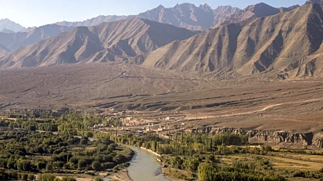
before politics drew lines on maps, the Indus and its tributaries had drawn the contours of one of the world’s oldest civilisations. The settlements of Harappa and Mohenjo-daro, the sophistication of their drainage systems, the deliberate placement of granaries and citadels—all of it was an early acknowledgement that a society can be only as durable as its relationship with water. By the time the British arrived in the nineteenth century, they inherited a hydraulic landscape thousands of years in the making. What they did with it would shape the politics of the subcontinent long after they were gone.
Between 1850 and 1940, the British built the largest contiguous canal irrigation network on earth across the Indus basin. The Upper Bari Doab Canal, the Lower Chenab Canal, the Triple Canals Project, the Sutlej Valley Project, each was an engineering response to a question that had been settled by geography millennia earlier. The basin’s rivers, fed by snowmelt and monsoon, ran in a north-east to south-west direction. Their headworks were in the upper plains, around Madhopur and Ferozepur, while the canals they fed flowed south and west, irrigating the cotton fields of central Punjab and the wheat lands of Sindh. The unity of this system was hydrological. It was about to become political.
The Radcliffe Line and Its Wounds
When Cyril Radcliffe’s boundary commission completed its work in August 1947, it inherited an impossible task. Five weeks to divide six provinces, two of which (Punjab and Bengal) were among the most intricately developed agricultural regions in the world. The line that emerged ran almost perpendicular to the flow of the Indus rivers. It placed the headworks of Madhopur and Ferozepur in India. The canals that drew from those headworks ran south into newly created Pakistan. A single irrigation network had been bisected overnight, with the upstream country on one side and the downstream country on the other.
Within nine months, the consequences arrived. On 1 April 1948, the Standstill Agreement that had been governing post-partition water flows expired. India, citing technical and administrative reasons, halted water deliveries through the canals that fed Pakistani Punjab. Crops withered. Pakistani officials, then occupied with the larger crisis of partition and Kashmir, scrambled to negotiate. The Inter-Dominion Accord, signed in May 1948, restored flows in exchange for Pakistani payments and a commitment that India would eventually develop alternative arrangements for Pakistani water needs. It was a temporary settlement. Nobody believed it would last.
A single irrigation network had been bisected overnight, with the upstream country on one side and the downstream country on the other.
The Question Geography Forced Open
The April 1948 incident is often retold in Indian and Pakistani historiography as an Indian act of aggression. The reality was more complex. India had inherited the headworks and the engineering infrastructure to control flows. Pakistan had inherited the canals and the agricultural economies dependent on them. Neither country had inherited a framework for managing rivers that flowed across a border that had not existed before August 1947. The question forced into the open was the question that geography had been asking since the first Harappan farmers diverted water onto their fields. Who owns a river that does not recognise borders?
The answers proposed in the years immediately following partition reflected the political assumptions of both countries. India’s position drew on the doctrine of upper-riparian sovereignty, the idea that the country in which a river rises has primary rights over its waters. Pakistan’s position invoked the doctrine of prior appropriation, the idea that established uses of a river create rights that cannot be unilaterally extinguished by an upstream state. Both doctrines have respectable lineages in international water law. Both could plausibly support the positions their proponents took.
The deeper problem was that the doctrines were incommensurable. There was no neutral authority capable of resolving them. The United Nations was newly established and absorbed in larger Cold War tensions. The International Court of Justice had no jurisdiction to compel adjudication. The bilateral relationship between India and Pakistan, already strained by the partition violence and the unresolved Kashmir question, could not produce a settlement on its own. For four years between 1948 and 1952, the matter remained unresolved, an open wound in an already complicated relationship.
Enter the World Bank
It was the World Bank that eventually made resolution possible, and it did so through the most unlikely of routes. In 1951, David Lilienthal, the former chairman of the Tennessee Valley Authority and a man with no particular brief on South Asia, visited the region to write for the American magazine Collier’s. He published an article suggesting that India and Pakistan should jointly develop the Indus basin, with technical assistance and financing from the World Bank. The proposal was unsolicited, written by a private citizen, and addressed to a problem that the bilateral parties had been unable to solve themselves. It caught the attention of Eugene Black, then president of the World Bank, who offered the bank’s mediation. By March 1952, both India and Pakistan had accepted.
What followed was eight years of negotiation. World Bank engineers worked alongside Indian and Pakistani teams to identify technical solutions. The bank pressed both governments through patient diplomacy. There were moments when negotiations nearly collapsed, particularly in 1958 and 1959, when the financial costs of constructing replacement infrastructure for Pakistan appeared insurmountable. What kept the process moving was Eugene Black’s persistence and the willingness of governments in both countries to entertain the idea that some problems are best solved through international mediation rather than bilateral confrontation.
On 19 September 1960, in Karachi, India’s Prime Minister Jawaharlal Nehru and Pakistan’s Field Marshal Ayub Khan signed the Indus Waters Treaty. The World Bank was a third signatory through Vice President WAB Iliff. The treaty divided the six rivers of the Indus system. The three eastern rivers, Ravi, Beas, and Sutlej, would go to India. The three western rivers, Indus, Jhelum, and Chenab, would go to Pakistan. The mathematics was simple. The mathematics was also a bargain whose long-term implications would take decades to become visible. India had agreed to a treaty under which it received roughly twenty per cent of the basin’s flow. Pakistan received the other eighty per cent.
Nehru would later tell Parliament that India had purchased a settlement. He believed the price was worth paying. Whether subsequent history vindicates that belief is the question the rest of this series will examine.
The writer is an author and columnist. His X handle is @ArunAnandLive. Views expressed are personal and solely those of the author, and do not necessarily reflect News18’s views.


/images/ppid_a911dc6a-image-178224023266177657.webp)


/images/ppid_59c68470-image-178222252506050470.webp)