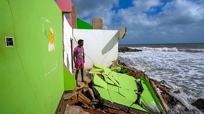


What's Happening?
A study published in Nature by researchers Katharina Seeger and Philip Minderhoud from Wageningen University reveals that sea levels are higher than previously estimated. The study analyzed 385 peer-reviewed studies on coastal flooding and sea-level rise,
finding that over 90% relied on mathematical models rather than actual ocean height measurements. These models, called geoids, do not account for tides, currents, and temperature differences, leading to underestimations of sea levels. The corrected data suggests that under a scenario of a 3-foot sea-level rise, up to 37% more land could be inundated than current assessments predict, affecting millions more people worldwide.
Why It's Important?
The findings have significant implications for coastal planning and risk assessments. Many regions, particularly lower-income areas with fewer local tide gauges, may face greater risks of flooding and land loss than previously thought. This could impact millions of people, especially in vulnerable regions like Southeast Asia and the Pacific. The study calls for updated assessments to ensure that coastal cities are adequately prepared for the true scale of sea-level rise, emphasizing the need for proactive planning and adaptation strategies.
What's Next?
The study's findings may prompt a reevaluation of current coastal management and planning strategies. Policymakers and planners will need to consider the revised sea-level data in their future assessments and infrastructure projects. This could lead to increased investments in flood defenses, relocation programs, and other adaptation measures to protect vulnerable communities. The study also highlights the importance of improving local monitoring and data collection to enhance the accuracy of future sea-level projections.