


What's Happening?
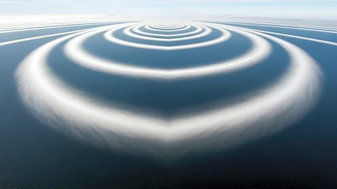
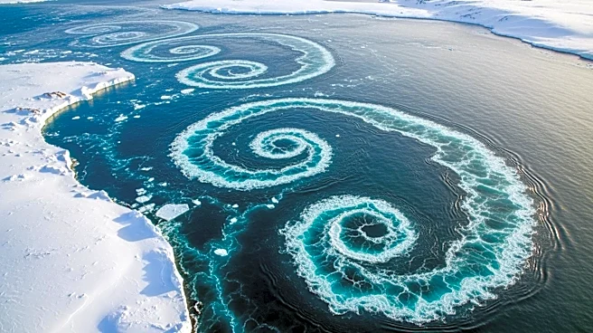
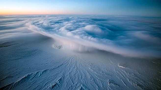
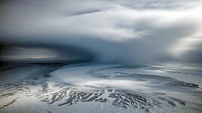
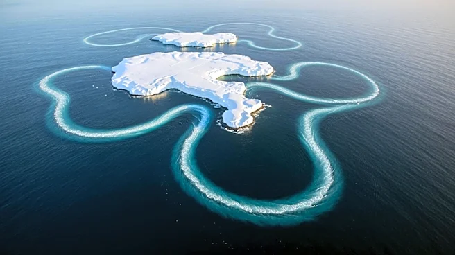
NASA's Landsat 8 satellite has captured a striking image of von Kármán vortex streets forming over Peter I Island in the Southern Ocean. These vortex streets are created when strong winds encounter a barrier, such as an island, causing the airflow to
deflect and spin into eddies. The image, taken on February 11, 2026, shows these counterrotating spirals downwind of the remote, ice-cloaked volcano. Peter I Island, located in the Bellingshausen Sea, is known for its challenging ice conditions and remote location, which have limited scientific research. The island was first discovered in 1821 by Russian explorer Fabian Gottlieb von Bellingshausen, but it wasn't until 1929 that anyone landed on it. NASA's Operation IceBridge campaign in 2011 surveyed the island, collecting measurements over Earth's polar ice to maintain observation records between satellite missions.
Why It's Important?
The image of von Kármán vortex streets over Peter I Island highlights the dynamic interactions between atmospheric conditions and geographical features. This phenomenon provides valuable insights into wind patterns and their effects on climate and weather systems. Understanding these interactions is crucial for climate science, as they can influence global weather patterns and contribute to climate change research. The remote location of Peter I Island makes it a unique site for studying these natural processes, offering a rare glimpse into the complexities of Earth's atmospheric dynamics. The data collected by NASA's satellite missions and airborne campaigns contribute to a broader understanding of polar regions, which are critical indicators of climate change impacts.