


What's Happening?
The National Oceanic and Atmospheric Administration (NOAA) has confirmed the presence of a 'Super El Niño' event, characterized by unusually warm ocean temperatures in the equatorial Pacific. This phenomenon, part of the El Niño-Southern Oscillation (ENSO)
cycle, began developing in June and is projected to continue into early spring of next year. The current El Niño is strengthening, with water temperatures in parts of the eastern tropical Pacific exceeding 4°C (about 7°F) above average in September. NOAA estimates an 83% chance that this El Niño will be stronger than any on record since 1950 during the October to December and November to January periods. This strong El Niño is expected to significantly alter winter conditions across the United States, influencing temperatures, precipitation, and extreme weather events. The effects are already being observed, with the Atlantic Hurricane season being one of the quietest on record due to El Niño's influence on atmospheric conditions.
Why It's Important?
The 'Super El Niño' carries significant implications for the United States, particularly concerning winter weather patterns. Historically, El Niño events lead to milder temperatures across the northern U.S. and a wetter, stormier winter for the southern U.S. This shift in weather can have diverse impacts on various sectors. For agriculture, altered precipitation patterns could affect crop yields, potentially leading to drought in some regions and excessive moisture in others. Infrastructure, especially in the southern states, may face increased risks of flooding and severe weather events. Energy consumption patterns could also change, with milder northern winters potentially reducing heating demands, while increased storm activity in the south could lead to power outages. The minimal hurricane activity in the Atlantic this season, attributed to El Niño, highlights its broad influence on natural disaster risks, potentially shifting focus to other weather-related hazards during the winter months.
What's Next?
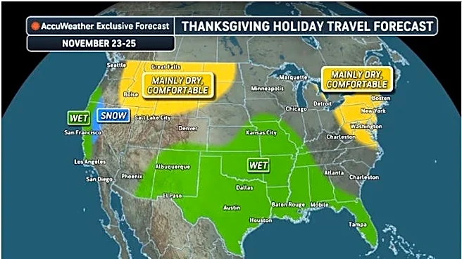
NOAA's Climate Prediction Center will continue to track the El Niño event and provide monthly updates. The current forecast indicates that the strong to very strong El Niño is likely to persist through the first quarter of 2027. For the U.S., the winter outlook for December 2026 through February 2027 follows the classic El Niño pattern: warmer across the North, and wetter across the southern tier and up the East Coast. This suggests that states in the southern half of the country, from California to the Carolinas, should prepare for increased rainfall and potential severe weather. Conversely, the northern tier, including the Pacific Northwest, northern Rockies, and Upper Midwest, can anticipate warmer and drier conditions. Homeowners and local authorities are advised to prepare for these anticipated changes, such as managing potential flooding risks in the south and addressing concerns about dry soil and reduced snow cover in the north.
Beyond the Headlines
The 'Super El Niño' underscores the complex interplay between oceanic and atmospheric conditions and their far-reaching effects on global climate. While El Niño is a natural phenomenon, its intensity and potential record-breaking strength raise questions about the influence of long-term climate change. The temporary warming effect of El Niño, combined with human-induced global warming, could contribute to new global temperature records. This event also highlights the critical role of scientific monitoring and forecasting agencies like NOAA in providing timely information for preparedness and mitigation efforts. The economic and social costs associated with extreme weather events, whether droughts or floods, can be substantial, affecting everything from insurance markets to public health. Understanding and adapting to these large-scale climate patterns is crucial for building resilience in communities and economies across the U.S.