


What's Happening?
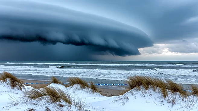
A powerful nor'easter is set to impact the Mid-Atlantic and Northeast regions, bringing more than a foot of snow, blizzard conditions, and coastal flooding from Sunday through Monday. The storm is expected to cause dangerous travel conditions, road closures,
and flight and school cancellations, particularly from Delaware to Massachusetts. The storm's track has shifted closer to the coast, affecting nearly 100 million people from Washington D.C. to Boston. Snowfall is expected to begin on Sunday, intensifying into the night and continuing until Monday night. The storm will undergo rapid intensification, known as bombogenesis, as it moves along the coast, leading to intense snow bands and significant accumulation.
Why It's Important?
The impending storm is significant due to its potential to disrupt daily life across a densely populated region. The heavy snowfall and blizzard conditions could lead to widespread power outages, travel disruptions, and economic impacts as businesses and schools may close. The storm's timing, coinciding with the start of the workweek, could exacerbate these disruptions. The potential for coastal flooding adds another layer of risk, particularly for communities along the coast. The storm's intensity and coverage make it a notable weather event, with the potential to affect millions of residents and travelers.
What's Next?
As the storm approaches, residents in the affected areas are advised to prepare for severe weather conditions. Authorities may issue additional warnings and advisories as the storm's path becomes clearer. Emergency services and utility companies are likely to be on high alert to respond to power outages and other storm-related issues. Residents are encouraged to stay informed through local news and weather updates and to follow any guidance from local officials regarding travel and safety precautions.