

What's Happening?
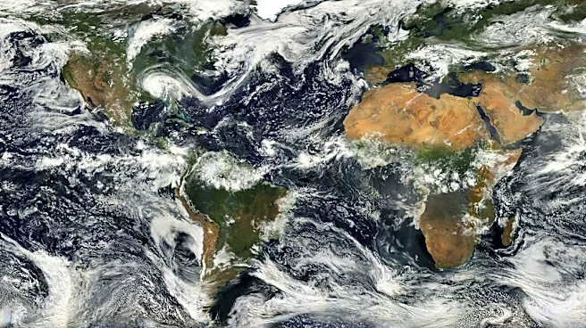
Federal climate forecasters from the National Oceanic and Atmospheric Administration (NOAA) indicate a powerful El Niño event is developing in the Pacific Ocean, with a 60% chance of becoming the strongest recorded since 1950. This phenomenon, characterized
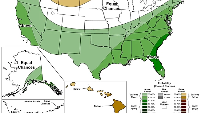
by unusually warm surface waters in the central and eastern tropical Pacific, is expected to alter atmospheric circulation and influence weather patterns across North America. NOAA's November 12 advisory reported ocean temperatures in the Niño-3.4 region reached 2.5 degrees Celsius above the reference average. The agency projects a more than 79% chance that strong to very strong El Niño conditions will persist through January–March 2027. This strengthening El Niño raises the likelihood of a warmer-than-normal winter for West Virginia and much of the eastern United States, including the Ohio Valley and Mid-Atlantic regions. While warmer temperatures are anticipated, the impact on precipitation, particularly snowfall, remains less certain for West Virginia.
Why It's Important?
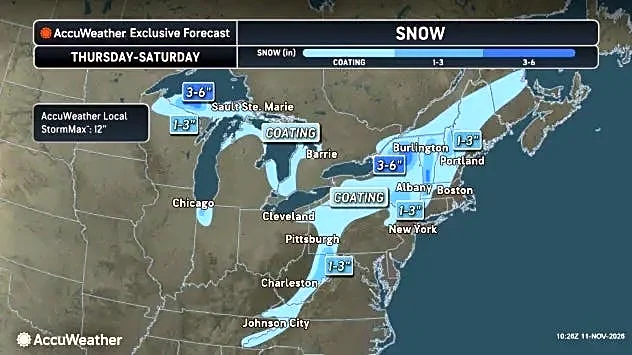
The potential for the strongest El Niño since 1950 carries significant implications for West Virginia and broader U.S. weather patterns. A warmer winter could reduce heating costs for residents and businesses, but it might also negatively impact winter sports industries, such as ski resorts, which rely on cold temperatures and natural snowfall. While NOAA's outlook favors above-average temperatures, the precipitation forecast is less clear. Historical research suggests that while El Niño generally leads to warmer and drier conditions in the Ohio Valley, snowfall patterns in West Virginia can vary, with eastern parts of the state sometimes experiencing above-average snowfall during strong El Niño winters. This variability means that despite warmer seasonal averages, individual heavy snow events are still possible, posing challenges for infrastructure and emergency services. The economic impact on agriculture, energy consumption, and tourism sectors across the region could be substantial, depending on the specific manifestations of this powerful El Niño.
What's Next?
NOAA's Climate Prediction Center is scheduled to release its next seasonal temperature and precipitation outlook on November 19, followed by its next El Niño diagnostic discussion on December 10. These updates will provide further guidance on the probability of warmer, colder, wetter, or drier conditions as West Virginia enters the winter season. While the overall outlook suggests warmer temperatures, the U.S. Geological Survey's regional assessment indicates that a stronger jet stream could lead to more frequent coastal storms along the eastern United States. These storms have the potential to bring heavy precipitation and snowfall if sufficient cold air is present, even within a generally warmer winter. Stakeholders, including state and local governments, businesses, and residents, will closely monitor these forecasts to prepare for potential impacts on energy demand, transportation, and outdoor activities. Ski resorts, for instance, are already preparing to rely on snowmaking regardless of natural snowfall.
Beyond the Headlines
The nuanced impact of El Niño on West Virginia's snowfall highlights the complex interplay of global climate phenomena and localized weather patterns. While broad regional trends, such as warmer winters in the Ohio Valley, are often associated with El Niño, specific geographical factors, like elevation and proximity to storm tracks, can significantly alter outcomes. The historical data showing varied snowfall in different parts of West Virginia during past El Niño events underscores that average seasonal forecasts do not preclude individual extreme weather events. This complexity presents a challenge for long-term planning and resource allocation, as communities must prepare for both the general trends and the potential for anomalous conditions. The ongoing strengthening of this El Niño event also serves as a reminder of the dynamic nature of Earth's climate systems and the continuous need for advanced meteorological research and adaptive strategies.