


What's Happening?
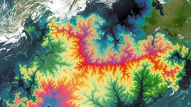
NASA has introduced TiTiler-CMR, an open-source library that enhances the customization of high-resolution satellite imagery for research and operational purposes. Integrated into NASA's Worldview application, TiTiler-CMR allows users to dynamically generate
custom composites by selecting specific spectral bands. This capability enables detailed analysis of various environmental conditions, such as vegetation health, drought impacts, and land use changes. The tool streamlines workflows by eliminating the need for data downloading or preprocessing, thus accelerating the transition from research ideas to scientific results. TiTiler-CMR supports a wide range of data-driven applications, providing users with efficient access to NASA's extensive satellite data archives.
Why It's Important?
The introduction of TiTiler-CMR represents a significant advancement in the accessibility and usability of satellite imagery for scientific research and practical applications. By allowing users to tailor imagery to specific needs, the tool enhances the ability to monitor and analyze environmental changes, which is crucial for addressing global challenges such as climate change and natural resource management. The ability to generate custom indices and composites facilitates more precise assessments of ecological conditions, supporting efforts in agriculture, forestry, and disaster response. This development underscores NASA's commitment to advancing data-to-action initiatives, providing valuable resources for researchers, policymakers, and industry stakeholders.
What's Next?
Future developments in the Worldview application will expand the capabilities of TiTiler-CMR, including the ability to generate true-color composites for the Arctic region. This will provide access to high-resolution imagery previously unavailable for this area, enhancing research opportunities in polar studies. Continued enhancements to the tool are expected to further streamline data access and visualization, supporting a broader range of scientific and operational applications. As the tool evolves, it may also facilitate new collaborations between NASA and other organizations focused on environmental monitoring and management.