


What's Happening?
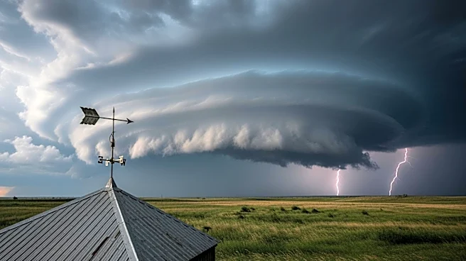
The Kansas City area is under a tornado watch as severe thunderstorms are expected to bring strong winds and potential tornadoes. The National Weather Service has issued multiple warnings for counties in both Kansas and Missouri, with wind gusts potentially
reaching up to 80 mph. The storms are part of a larger weather system moving through the region, with the most significant threats being strong straight-line winds and large hail. Residents are advised to secure outdoor items and stay informed through weather alerts as the storms are expected to impact the area during peak evening commute hours.
Why It's Important?
The severe weather poses significant risks to the Kansas City area, including potential property damage from high winds and hail. The issuance of a tornado watch highlights the need for residents to be prepared for possible tornadoes, which can cause widespread destruction. The timing of the storms during the evening commute increases the risk of accidents and disruptions. This situation underscores the importance of having reliable communication systems in place for weather alerts and emergency preparedness plans to ensure public safety.
What's Next?
As the storm system moves through the area, residents should remain vigilant and follow updates from local authorities. The National Weather Service will continue to monitor the situation and provide updates as necessary. Once the storms pass, the region is expected to experience calmer weather over the weekend, providing an opportunity for recovery and assessment of any damage. Long-term, this event may prompt discussions on improving infrastructure resilience and emergency response strategies in the face of severe weather events.