
What's Happening?
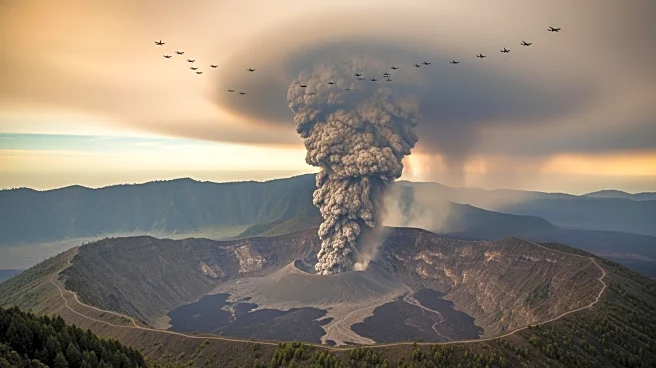
In late November, the Hayli Gubbi volcano in Northern Ethiopia's Danakil Depression erupted explosively, sending a massive plume of ash and volcanic gases into the atmosphere. The eruption was captured
by the MODIS instrument on NASA's Aqua satellite just four hours after it began. The ash plume reached approximately 9 miles above sea level and drifted northeast, affecting air travel as far away as India. The Danakil Depression is a geologically dynamic area where the African and Arabian tectonic plates are pulling apart, allowing magma to rise close to the surface. This region is home to a chain of shield volcanoes, including Hayli Gubbi, which has no recorded eruptive history in the modern era.
Why It's Important?
The eruption of Hayli Gubbi highlights the significance of satellite technology in monitoring remote and understudied volcanic regions. The new satellite imagery provides the first observational record of the volcano's activity, establishing a baseline for future scientific analysis. This data is crucial for understanding the tectonic activity in the area and its potential impact on global air travel and climate. The disruption of flights underscores the broader implications of volcanic eruptions on international travel and commerce, emphasizing the need for continuous monitoring and preparedness in managing such natural events.
What's Next?
The data collected from the Hayli Gubbi eruption will likely lead to increased scientific interest and research in the Danakil Depression. Scientists may use this information to enhance predictive models for volcanic activity and its potential impacts. Additionally, there may be efforts to improve international collaboration in monitoring volcanic regions that pose risks to global air travel. The eruption serves as a reminder of the importance of investing in Earth-observing technologies to mitigate the effects of natural disasters.
Beyond the Headlines
The eruption of Hayli Gubbi also raises questions about the long-term environmental impacts of volcanic activity in the region. The release of volcanic gases can contribute to atmospheric changes, affecting weather patterns and climate. Furthermore, the event highlights the challenges of studying remote and inaccessible areas, where direct observation is limited. The use of satellite technology in these regions not only aids in immediate response efforts but also contributes to a deeper understanding of Earth's geological processes.