







What's Happening?
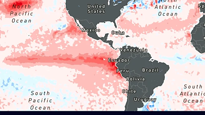
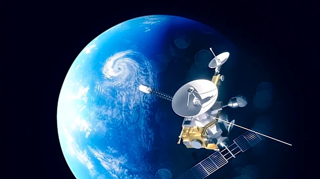
NASA, in collaboration with its European partners, is employing the Sentinel-6B satellite and its predecessor, Sentinel-6 Michael Freilich, to gather precise sea level height measurements. This initiative is crucial for understanding and predicting the impacts
of a stronger-than-normal El Niño event, which began in the middle of the year and is now reaching significant strength, comparable to events in 1997 and 2015. The satellites are part of the Copernicus Sentinel-6/Jason-CS mission, which has continuously monitored Earth's changing seas since the early 1990s. Data collected by these satellites, including ocean height, wave size, and marine wind speed, is being used to improve hurricane forecasts and understand how El Niño redistributes ocean heat, affecting sea levels and hurricane activity. Sentinel-6B began delivering low-latency data to scientists on July 15, which will eventually be integrated into research models to enhance weather predictions.
Why It's Important?
The enhanced hurricane forecasting capabilities provided by the Sentinel-6 missions are vital for protecting U.S. coastal communities and infrastructure. More accurate predictions of hurricane strength and rapid intensification can significantly improve disaster response efforts by federal and state agencies, including the Federal Emergency Management Agency (FEMA). This allows for better-informed decisions regarding resource mobilization, such as sandbag placement and National Guard activation, and timely evacuation orders. Given that hurricanes can rapidly intensify in the 48 hours before landfall, precise forecasting is critical for saving lives and minimizing economic damage. The data also contributes to a long-term dataset of sea level observations, extending back to 1992, which is essential for understanding climate change and its impact on ocean dynamics.
What's Next?
Scientists anticipate incorporating the ocean height data from the Sentinel-6 missions into NOAA's Satellite Ocean Heat Content Suite algorithm by the end of the year. This integration is expected to further refine hurricane forecasting models. Sentinel-6B is also slated to take over as the reference satellite for global sea level measurements later this year, ensuring the continuity and consistency of this critical dataset. The ongoing collection and analysis of data from these satellites will continue to inform meteorologists and climate scientists, leading to more robust predictions and better preparedness for future El Niño events and hurricane seasons. The long-term goal is to consistently measure ocean parameters to predict hurricanes and protect vulnerable coastal regions.
Beyond the Headlines
The Sentinel-6 missions highlight the critical role of international collaboration in addressing global environmental challenges. The joint effort by ESA, EUMETSAT, NASA, and NOAA, with support from the European Commission and the French space agency CNES, underscores the interconnectedness of scientific research and its practical applications. Beyond immediate hurricane forecasting, the continuous monitoring of sea levels and ocean heat content provides invaluable data for climate science, helping to track long-term changes in Earth's climate system. This data is fundamental for understanding the broader implications of phenomena like El Niño on global weather patterns, marine ecosystems, and coastal resilience, influencing policy decisions related to climate adaptation and mitigation strategies.