





What's Happening?
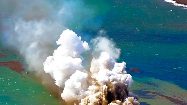
Indonesia's Anak Krakatau volcano has expanded by 81 acres following recent eruptions that produced lava flows. The country's Geology Agency reported that satellite imagery, specifically Sentinel images from August 8 and September 15, revealed this increase
in landmass. Additionally, two new land formations have been detected near the volcano. One formation is approximately 760 meters northwest of Anak Krakatau’s coastline, and the other is about 495 meters southeast. These formations, located on either side of the volcano's crater, are believed to be linked to the recent eruptions. The volcano erupted for 25 hours between September 4 and September 6, directing lava towards the northwest, west, and southwest. Further analysis and more recent data are required to confirm if these new formations are indeed new eruption centers. Anak Krakatau is one of approximately 130 active volcanoes in Indonesia, a region situated on the 'Pacific Ring of Fire,' known for its high seismic and volcanic activity.
Why It's Important?
The continuous expansion and formation of new land by Anak Krakatau highlight the dynamic geological processes occurring within the 'Pacific Ring of Fire.' This region is characterized by the meeting of different tectonic plates, leading to frequent earthquakes and volcanic eruptions. The emergence of new landmasses, while a natural phenomenon in volcanic areas, underscores the unpredictable and powerful nature of these geological forces. For Indonesia, a nation with a high density of active volcanoes, such developments necessitate ongoing monitoring and preparedness. The potential for new eruption centers could alter the local landscape and impact surrounding communities, requiring adjustments to safety protocols and land use planning. The 1883 eruption of Krakatoa, the predecessor to Anak Krakatau, serves as a historical reminder of the catastrophic potential of these volcanoes, which caused tsunamis and resulted in over 36,000 fatalities. Understanding these changes is crucial for mitigating future risks and ensuring public safety in volcanically active zones.
What's Next?
Authorities will continue to monitor Anak Krakatau closely, with a focus on analyzing new data and satellite imagery to determine the nature and stability of the recently formed landmasses. The Geology Agency has indicated that more recent data and further analysis are needed to confirm if these formations are new eruption centers. This ongoing assessment will be critical for updating hazard maps and refining safety guidelines for the surrounding areas. Given Indonesia's location on the 'Pacific Ring of Fire,' continuous surveillance of all active volcanoes is a standard procedure. The long-term stability of these new formations will also be evaluated, as they may be subject to erosion or further volcanic activity. Any significant changes could lead to revised recommendations for maritime traffic and local populations, particularly regarding exclusion zones around the volcano.
Beyond the Headlines
The emergence of new land formations from Anak Krakatau offers a tangible illustration of geological evolution in real-time. This process, while potentially hazardous, also contributes to the Earth's ever-changing geography. From a scientific perspective, these events provide invaluable data for volcanologists and geologists studying plate tectonics, magma dynamics, and the mechanisms of island formation. Culturally, volcanoes like Anak Krakatau often hold significant meaning for local communities, influencing folklore, spiritual beliefs, and traditional practices. The constant interplay between destructive power and creative force inherent in volcanic activity shapes both the physical environment and human societies in these regions. Understanding these deeper implications can foster a more holistic approach to disaster preparedness, integrating scientific knowledge with local wisdom and cultural perspectives to build resilience in the face of natural phenomena.