
What's Happening?
Early November in the U.S. has seen record warm temperatures east of the Continental Divide, consistent with an El Niño climate, resulting in below-normal early season heating demand. However, a shift
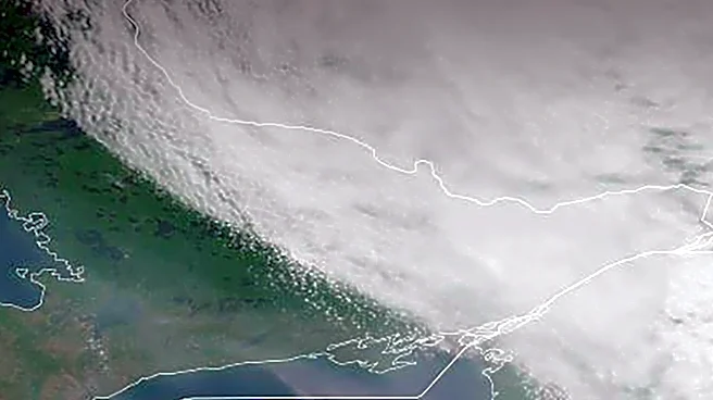
towards a colder regime is anticipated by late November. Marginal chill is expected to begin the week in the Midwest, with morning temperatures near or slightly below freezing. Despite this, the U.S. will remain warm nationally through midweek. By Wednesday night, low pressure will organize in Ohio, bringing a cool air mass to the Upper Midwest. This cooler air will push into the Southeast by Thursday, while the Great Lakes region experiences borderline cold conditions. By Friday, chilly weather is forecast from the Great Lakes to the Gulf Coast, with the coolest anomalies in the South and chilly rain in New England. An atmospheric river is also expected to bring precipitation to the West Coast of Canada and the Coastal Northwest States this week, while the rest of the West remains dry and warmer than normal.
Why It's Important?
The predicted shift in weather patterns has significant implications for various sectors across the U.S. The initial warm spell has kept heating demand below normal, impacting energy consumption and potentially energy prices. However, the anticipated colder regime in late November could lead to a rapid increase in heating demand, affecting utility companies, energy markets, and consumer costs. For agriculture, the fluctuating temperatures and regional precipitation patterns could influence crop conditions and harvesting schedules. The atmospheric river on the West Coast is crucial for water resources but also carries risks of flooding and mudslides. Businesses reliant on weather-dependent operations, such as construction and outdoor recreation, will need to adapt to these changing conditions. The overall trend suggests a dynamic weather period that will require careful monitoring and preparation from both industries and the public.
What's Next?
In the 6-10-day period, an amplified upper air pattern is expected, featuring deep troughs on both coasts. The eastern trough will deliver cool air, with the coolest anomalies in the Southeast, while the western trough will force a persistent atmospheric river pattern shifting south to California. The 11-15-day period shows the upper trough buried in the Southwest U.S., leading to a southerly surge of moisture into the Great Plains and a warm weather return in the East. Despite some cooler periods, U.S. gas population weight HDD projections remain warmer than the 10-year normal through Thanksgiving Day. However, week 3-5 HDD projections are trending colder, with several forecasts supporting a potential 'polar vortex' pattern and negative arctic oscillation, suggesting a chilly end to November. Stakeholders in energy, agriculture, and logistics will need to monitor these evolving forecasts closely.
Beyond the Headlines
The evolving weather patterns, particularly the shift from an El Niño-influenced warm early November to a potentially colder late November, highlight the complexities of climate variability and its immediate impacts. The mention of a potential 'polar vortex' pattern and negative arctic oscillation points to larger atmospheric dynamics that can significantly influence continental weather. This variability poses challenges for long-term planning in sectors like energy infrastructure and disaster preparedness, as extreme shifts can strain resources. The contrast between the initial warmth and the impending cold also underscores the importance of accurate and timely meteorological forecasting for public safety and economic stability. Furthermore, these shifts can subtly influence public perception and discussions around climate change, even if individual weather events are part of natural variability.