
What's Happening?
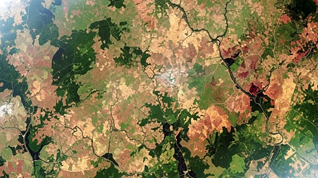
NASA's Landsat program plays a crucial role in monitoring and managing rangelands, which cover over half of Earth's terrestrial surface. These rangelands, characterized by native grasses, forbs, and shrubs,
are essential for grazing livestock and wildlife. The recently published Rangelands ATLAS highlights that rangelands consist of seven different biomes, including deserts, shrublands, grasslands, woodlands, savannas, and tundra. Landsat data provides valuable insights into the health and productivity of these ecosystems, which are vital for food production and ecological services. The Bureau of Land Management oversees rangelands in eastern Idaho, utilizing them for grazing and recreation. Landsat's remote sensing capabilities allow scientists and land managers to assess vegetation health and guide land management decisions, such as grazing regimes, by evaluating imagery and vegetation indices during various growing periods.
Why It's Important?
The use of Landsat data in rangeland management is significant due to the vastness and ecological importance of these areas. Rangelands support food production for a growing global population and offer cultural and aesthetic value. Effective management of these lands is crucial for maintaining their ecological services and ensuring sustainable livestock grazing. Landsat's ability to provide comprehensive data on vegetation health and productivity helps land managers make informed decisions, especially in arid and semi-arid ecosystems where vegetation growth is highly variable. This technology enhances the ability to monitor changes over time, ensuring that rangelands remain a viable resource for future generations.
What's Next?
Continued advancements in remote sensing technology, such as Landsat, will likely improve the precision and effectiveness of rangeland management. As climate change impacts precipitation patterns and vegetation growth, the need for accurate monitoring tools becomes increasingly important. Future developments may include integrating Landsat data with other satellite technologies to provide even more detailed insights into rangeland ecosystems. Stakeholders, including government agencies and environmental organizations, may collaborate to enhance data sharing and management practices, ensuring the sustainability of these critical landscapes.
Beyond the Headlines
The integration of Landsat data into rangeland management highlights the broader trend of using technology to address environmental challenges. This approach not only aids in preserving biodiversity but also supports sustainable agricultural practices. The ethical implications of managing rangelands with advanced technology include balancing ecological preservation with human needs for food and resources. As technology continues to evolve, it may offer new solutions for managing other natural resources, promoting a more sustainable interaction between humans and the environment.