
What's Happening?
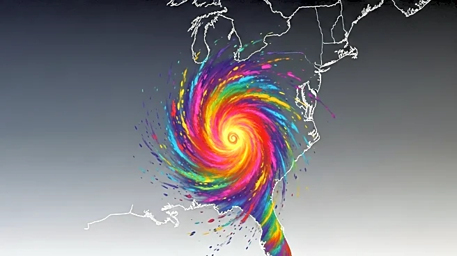
A storm system currently moving northwest from Cuba is expected to develop into Tropical Storm Imelda by the end of the weekend, according to the National Hurricane Center. The storm is forecast to bring storm surges and high winds to the Southeast U.S. coastline early next week. A tropical storm warning is in effect for the central and northwestern Bahamas, with potential impacts including flash and urban flooding. The storm is anticipated to reach Category 1 hurricane intensity as it approaches the U.S. coast.
Why It's Important?
The impending storm poses a significant threat to coastal regions in the Southeast U.S., including Georgia, the Carolinas, and mid-Atlantic states. The potential for flooding and high winds could lead to property damage, power outages, and disruptions to daily life. Emergency preparedness and response efforts will be crucial in minimizing the impact on affected communities. The storm also highlights the ongoing challenges of managing extreme weather events in the context of climate change.
What's Next?
As the storm approaches, local authorities and emergency services are likely to issue evacuation orders and prepare for potential impacts. Residents in affected areas are advised to monitor weather updates and take necessary precautions to ensure safety. The National Hurricane Center will continue to provide forecasts and updates as the storm progresses.