


What's Happening?
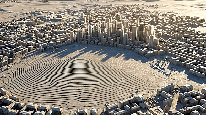
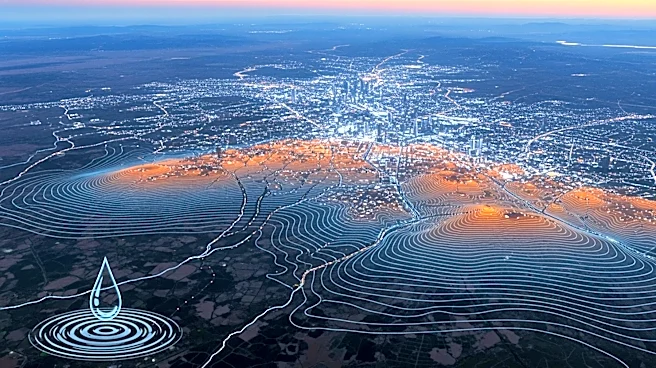
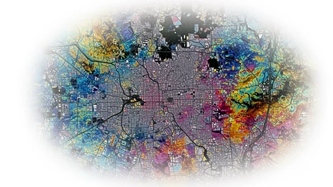
Mexico City is experiencing significant subsidence, sinking nearly 10 inches annually, as revealed by new satellite imagery from NASA. The city, built on an ancient lake bed, has been sinking for over a century due to extensive groundwater pumping and
urban development. This subsidence has led to visibly tilted monuments and buildings, such as the Metropolitan Cathedral. The contracting aquifer has exacerbated a chronic water crisis, affecting critical infrastructure like the subway and water systems. NASA's NISAR satellite, a joint initiative with the Indian Space Research Organization, has provided detailed measurements of the subsidence, highlighting the severity of the issue.
Why It's Important?
The rapid sinking of Mexico City poses significant challenges for urban planning and infrastructure maintenance. The subsidence affects essential services, including transportation and water supply, potentially leading to increased costs and disruptions for residents. The data from NASA's satellite offers valuable insights for scientists and policymakers to address the subsidence issue and mitigate its impacts. Understanding the subsidence patterns can help in planning long-term solutions and improving alert systems for natural disasters. The technology used in this study could be applied globally to monitor similar issues in other regions, enhancing disaster preparedness and response strategies.
What's Next?
Researchers and government officials are expected to use the data from NASA's satellite to develop strategies for mitigating the effects of subsidence in Mexico City. This may involve stabilizing infrastructure and improving water management practices. The technology could also be used to enhance alert systems for natural disasters, providing early warnings for events like volcanic eruptions. Continued research and investment in understanding subsidence patterns will be crucial for developing effective solutions and minimizing the impact on residents and infrastructure.
Beyond the Headlines
The subsidence issue in Mexico City highlights broader environmental and urban planning challenges faced by rapidly growing cities. The reliance on groundwater and the impact of urban development on natural resources are critical concerns that require sustainable management practices. The use of advanced satellite technology to monitor subsidence offers a new approach to understanding and addressing these challenges, potentially leading to more informed policy decisions and improved urban resilience.