


What's Happening?
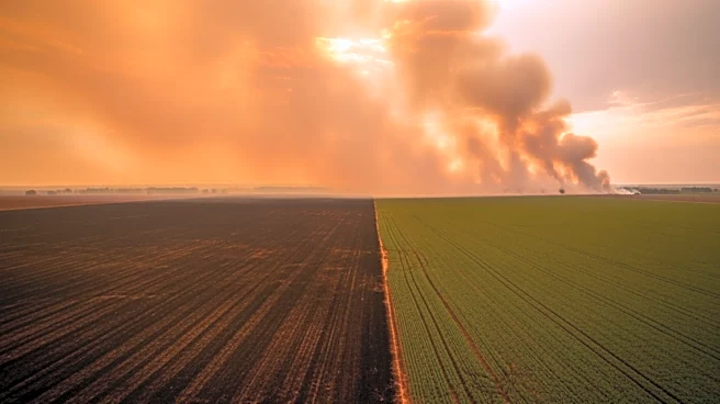
Florida is facing a severe weather threat as a line of thunderstorms moves across the state, bringing the risk of tornadoes, damaging winds, and heavy rain. The National Weather Service has identified northern and central Florida as areas of concern,
with the potential for isolated tornadoes and significant rainfall. This weather event comes as Florida is experiencing severe drought conditions, with parts of the state labeled as extreme and exceptional drought areas. The incoming rain is expected to provide short-term relief for wildfire risks but is unlikely to resolve the broader drought issues.
Why It's Important?
The severe weather poses a dual threat to Florida, with the potential for both storm damage and ongoing drought challenges. The risk of tornadoes and severe storms highlights the need for preparedness and effective warning systems to protect residents. At the same time, the drought conditions exacerbate the risk of wildfires, posing a significant threat to communities and ecosystems. The situation underscores the complex interplay between weather patterns and environmental conditions, necessitating coordinated efforts to manage and mitigate these risks.
What's Next?
Emergency managers are urging residents to stay informed and prepared for severe weather, with multiple ways to receive alerts. While the immediate focus is on the storm threat, the ongoing drought and wildfire risks remain a concern. Officials emphasize the need for continued vigilance and preparedness, as well as the importance of long-term strategies to address drought and enhance resilience to extreme weather. The situation in Florida serves as a reminder of the broader challenges posed by climate variability and the need for adaptive management approaches.