








What's Happening?
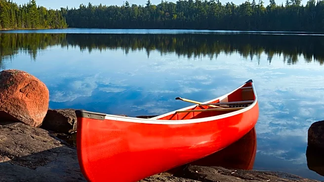
Navigating the Boundary Waters Canoe Area Wilderness (BWCAW) in the Superior National Forest critically depends on physical maps due to the absence of reliable cell service and GPS functionality. The BWCAW, spanning over one million acres with more than
1,000 lakes, presents a complex environment where electronic devices are prone to failure from battery drain or water damage. Therefore, a high-quality, waterproof physical map is considered an essential survival tool for all visitors. These maps provide granular detail necessary to distinguish between similar-looking bays, identify portages, and plan routes effectively. Key map publishers for the BWCAW include Fisher Maps, McKenzie Maps, and Voyageur Maps, each offering different scales and levels of detail to suit various navigation preferences and trip requirements.
Why It's Important?
The reliance on physical maps in the BWCAW underscores the importance of traditional navigation skills in an increasingly digital world. This necessity highlights a critical safety and preparedness aspect for wilderness adventurers, emphasizing that technology cannot always replace fundamental outdoor competencies. For the outdoor recreation industry, it reinforces the demand for durable, accurate, and user-friendly physical maps, influencing product development and market strategies for cartographers and outdoor gear manufacturers. Furthermore, it serves as a reminder for public land management agencies about the importance of maintaining clear and consistent mapping standards for wilderness areas where digital navigation is impractical. This also impacts tourism in regions like Northern Minnesota, as visitors must be educated on proper navigation techniques and map usage before entering the wilderness.
What's Next?
Visitors planning trips to the BWCAW will continue to require permits for specific entry points and dates, necessitating careful route planning using physical maps. The ongoing development of interactive digital maps for pre-trip scouting will likely continue, but these will serve as supplementary tools rather than replacements for physical maps in the field. Educational initiatives focusing on map reading, compass skills, and wilderness safety will remain crucial for new and experienced paddlers alike. Map publishers will likely continue to update their offerings to reflect environmental changes, such as those caused by forest fires, and to incorporate user feedback. The emphasis on traditional navigation methods will persist as long as the BWCAW remains a 'dead zone' for modern communication and GPS technologies.
Beyond the Headlines
The enduring necessity of physical maps in the BWCAW speaks to a broader philosophical point about human interaction with nature and technology. In an era dominated by instant digital information, the wilderness demands a slower, more deliberate engagement with one's surroundings and a reliance on foundational skills. This can foster a deeper connection to the environment and enhance self-reliance. The act of reading a physical map, understanding contour lines, and orienting oneself with a compass can be a meditative and empowering experience, contrasting sharply with the passive consumption of digital navigation. It also highlights the inherent limitations of technology in certain extreme or remote environments, reminding us of the value of analog tools and skills for resilience and survival.