







What's Happening?
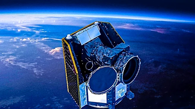
China's Gaofen satellite program, the civil backbone of the China High-resolution Earth Observation System (CHEOS), continues to expand its capabilities. Approved in 2010, the program has grown into a fleet of 35 tracked satellites since the launch of Gaofen-1
in 2013. This constellation includes a variety of satellites such as wide-swath agricultural mappers, sub-meter urban imagers, all-weather radar, and hyperspectral atmospheric sensors. The Gaofen series provides imagery that supports land surveys, agriculture, disaster response, and environmental enforcement across China. Some of these products are also offered to Belt and Road partner states. The program's highest-resolution civil imagery can resolve sub-meter details, such as objects the size of a car, from an altitude of 500 km. Lower-resolution products (16 m class) are freely distributed through the CNSA data portal, while sub-meter imagery remains government-controlled.
Why It's Important?
The expansion of China's Gaofen satellite program signifies a significant advancement in Earth observation technology and its applications. For the U.S. and global stakeholders, this development has implications for international data sharing, environmental monitoring, and strategic intelligence. The program's ability to provide high-resolution imagery for diverse applications, from crop-yield forecasting to pollution enforcement, demonstrates China's growing technological prowess in space. While lower-resolution data is publicly accessible, the government control over sub-meter imagery highlights potential strategic advantages for China in areas like urban planning and mapping. The program's reach extends to Belt and Road partner states, indicating a broader geopolitical influence through technological assistance and data provision. This could impact global data markets and the balance of power in space-based intelligence gathering, potentially influencing U.S. foreign policy and commercial satellite imaging industries.
What's Next?
The Gaofen program is expected to continue its expansion, with ongoing developments in satellite technology and applications. The program's focus on providing imagery for various civil applications suggests a continued effort to enhance China's domestic capabilities in areas like disaster management and environmental protection. The distribution of lower-resolution data through the CNSA data portal indicates a commitment to some level of international data sharing, particularly with Belt and Road partners. However, the continued government control over high-resolution imagery suggests that strategic applications will remain a priority. Future developments may include further improvements in resolution, sensor types, and data processing capabilities, potentially leading to more sophisticated applications. The program's trajectory will likely influence international norms around satellite data access and usage, prompting other nations, including the U.S., to assess their own Earth observation strategies and investments.
Beyond the Headlines
Beyond its immediate applications, the Gaofen program reflects China's long-term strategic vision for space dominance and technological self-reliance. The program's dual-use nature, with civil applications often paralleling military capabilities (as seen with the Yaogan reconnaissance fleet), raises questions about the blurred lines between civilian and military space assets. This has broader implications for international security and arms control in space. The program's emphasis on providing data to Belt and Road partners also underscores China's efforts to build a sphere of influence through technological diplomacy. This could lead to increased reliance on Chinese space infrastructure by developing nations, potentially shifting geopolitical alignments. The ethical considerations surrounding data privacy and the potential for surveillance using high-resolution imagery also become more prominent as such capabilities advance globally. The U.S. and its allies will need to navigate these complex issues, balancing cooperation with competition in the rapidly evolving landscape of space technology.