





What's Happening?
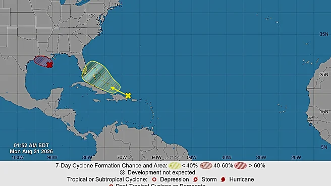
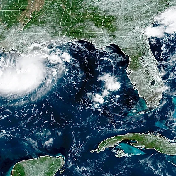
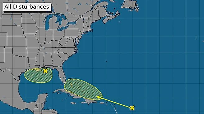
A tropical storm warning has been issued for portions of southeast Texas along the Gulf Coast, as a weather system designated Invest 97L continues to develop in the north central Gulf. While the warning currently covers areas from Port Bolivar eastward
into Louisiana, heavy rainfall is anticipated across a broader region, including Houston and Galveston. The National Hurricane Center and National Weather Service (NWS) predict that Invest 97L could intensify into a short-lived tropical storm before making landfall. Scattered thunderstorms are expected to begin Monday night, escalating throughout Tuesday. Rainfall rates could exceed 3-4 inches per hour during peak downpours, with isolated areas potentially receiving 6-9 inches of total rainfall. Houston is forecast to receive up to 3 inches, and Galveston up to 4 inches. There is also a possibility of tropical storm force winds along southeast Texas counties starting Tuesday morning, though the overall wind threat for the state remains low.
Why It's Important?
This developing weather system poses a significant risk of flash flooding across southeast Texas, which can lead to dangerous conditions for residents and substantial disruption to infrastructure. The potential for high rainfall rates, exceeding 3-4 inches per hour, means that even areas not directly under the tropical storm warning could experience rapid water accumulation and localized flooding. Such events can overwhelm drainage systems, close roads, and impact daily commutes, potentially leading to economic losses due to business closures and property damage. For coastal communities, the combination of heavy rain and possible tropical storm force winds, even if short-lived, increases the risk of power outages and coastal erosion. Emergency services and local authorities will need to be prepared for rapid response, and residents are advised to monitor forecasts closely and take necessary precautions to ensure safety and minimize potential damage.
What's Next?
Residents in southeast Texas, particularly in Houston and Galveston, should prepare for increased rainfall and potential flash flooding throughout Tuesday and Wednesday. The National Weather Service advises monitoring for updates as the forecast may fluctuate depending on the system's evolution. Emergency management agencies will likely issue further advisories and potentially activate flood response protocols. Localized instances of flash flooding are plausible, especially in areas east of I-45, where rainfall totals could be higher. While the wind threat is currently low for most of the region, coastal areas should remain vigilant for tropical storm force winds. If Invest 97L intensifies into a named storm, it would be called Edouard, though meteorologists anticipate it would be short-lived before moving over land. Communities should review their emergency plans and secure any outdoor items that could be affected by strong winds or heavy rain.
Beyond the Headlines
The recurring threat of tropical systems and associated heavy rainfall in the Gulf Coast region highlights the ongoing challenges faced by urban centers like Houston in managing water infrastructure and urban development. Flash flooding, even from systems that don't reach hurricane strength, can have disproportionate impacts on vulnerable communities, exacerbating existing social and economic inequalities. The need for resilient infrastructure, effective early warning systems, and community preparedness becomes paramount. This event also underscores the importance of individual responsibility in heeding weather warnings and taking proactive measures, such as avoiding flooded roads and having emergency kits ready. The long-term implications of such weather patterns may necessitate further investment in flood mitigation projects and urban planning strategies designed to adapt to increasingly frequent and intense rainfall events.