





What's Happening?
NASA scientists have developed a new method to map the bedrock beneath Greenland's vast ice sheet, revealing an expansive network of previously hidden valleys. This innovative technique, called Ice Flow Perturbation Analysis, utilizes subtle bumps and dips
on the ice surface, detected by satellites, to infer the shape of the underlying landscape. The new map has identified 1,943 subglacial valleys, with approximately one-third being newly discovered. Furthermore, about half of the valleys previously known, primarily near the ice sheet's edge, are now understood to extend significantly farther inland, in some cases by hundreds of kilometers. This discovery provides a more detailed and accurate view of Greenland's hidden topography, offering new insights into the island's geological history and the formation of its ice sheet. The findings were published in Geophysical Research Letters.
Why It's Important?
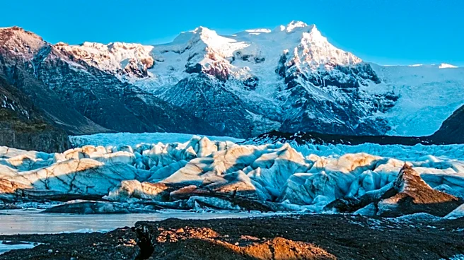
This discovery is crucial for refining projections of the Greenland ice sheet's future behavior and its potential impact on global sea levels. The newly mapped valleys provide critical context for understanding how the ice sheet formed and how it interacts with the underlying terrain. Ice flow concentrates in these valleys, forming glaciers that eventually calve into fjords. A better understanding of this subglacial topography allows scientists to predict how ice flow will continue to accelerate as the ice sheet retreats. The presence of long, straight valleys with a southwest-northeast alignment suggests a tectonic influence, challenging previous assumptions about Greenland's geological stability. This new data will improve high-resolution datasets like BedMachine Greenland, enhancing climate models and our ability to forecast the effects of ice sheet melt on coastal communities and ecosystems worldwide.
What's Next?
The immediate next step involves integrating this new topographical data into existing ice sheet models to improve their accuracy. Researchers will continue to investigate the puzzling aspects of the newly mapped topography, particularly the tectonic influences suggested by the valley alignments. Further studies will focus on understanding the role of widespread groundwater networks in carving these valleys before the ice sheet formed. The enhanced understanding of the bedrock will allow scientists to make more precise predictions about the long-term retreat of the Greenland ice sheet and its implications for sea-level rise. This will inform policy decisions related to climate change mitigation and adaptation strategies for vulnerable coastal regions.
Beyond the Headlines
The uncovering of these ancient valleys beneath Greenland's ice sheet offers a profound glimpse into Earth's geological past, revealing a landscape that has been hidden for millennia. The discovery challenges existing geological models of Greenland, suggesting a more dynamic tectonic history than previously understood. The implications extend beyond glaciology, touching upon the broader fields of geology and paleogeography. Understanding the interplay between ice flow and subglacial topography also highlights the immense power of natural forces to shape planetary surfaces over vast timescales. This research underscores the continuous evolution of our planet and the complex feedback loops between geological processes and climate, providing a deeper appreciation for the Earth's intricate systems.