


What's Happening?
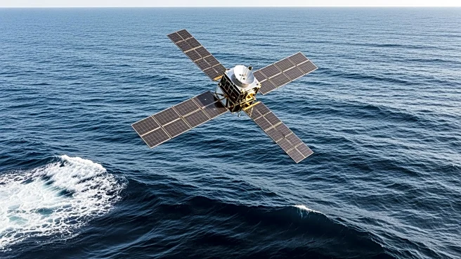
Sentinel-6B, a satellite developed by NASA and its European partners, has successfully captured its first data on sea levels across a vast stretch of the Atlantic Ocean. Launched from Vandenberg Space Force Base on November 16, 2025, the satellite is
part of the Copernicus Sentinel-6/Jason-CS mission, which aims to survey 90% of the world's oceans. The data collected on November 26, 2025, marks the first measurements sent back by Sentinel-6B, extending a decades-long effort to track ocean height with precision. The satellite, about the size of a pickup truck, uses radar altimetry to measure ocean height down to fractions of an inch. The mission is a collaborative effort involving NASA, the European Space Agency (ESA), EUMETSAT, and the National Oceanic and Atmospheric Administration (NOAA), with funding support from the European Commission and technical support from the French space agency, Centre National d'Études Spatiales.
Why It's Important?
The successful deployment and data collection by Sentinel-6B are crucial for understanding and monitoring global sea level changes, which are significant indicators of climate change. By providing precise measurements of ocean height, the satellite helps scientists track the effects of global warming, such as melting ice caps and thermal expansion of seawater. This data is vital for predicting future sea level rise and its potential impact on coastal communities, infrastructure, and ecosystems. The mission's continuation of the long-term ocean monitoring efforts ensures that policymakers and researchers have access to reliable data to inform climate-related decisions and strategies. The collaboration between U.S. and European agencies highlights the importance of international cooperation in addressing global environmental challenges.
What's Next?
As Sentinel-6B continues its mission, it will work alongside its twin satellite, Sentinel-6 Michael Freilich, which launched in 2020, to provide comprehensive data on ocean levels. The ongoing collection and analysis of this data will enhance the understanding of ocean dynamics and contribute to climate models. Future steps include integrating Sentinel-6B's data with other sea level satellites to create a more detailed and accurate global sea level map. This information will be crucial for developing adaptive strategies to mitigate the impacts of rising sea levels on vulnerable regions. Additionally, the mission's success may pave the way for further international collaborations in space-based environmental monitoring.