



What's Happening?
A new NASA satellite, the Surface Water and Ocean Topography satellite, has uncovered significant flaws in computer models used to understand rivers, particularly in the American West. Researchers found serious modeling errors in nearly 10% of the river stretches
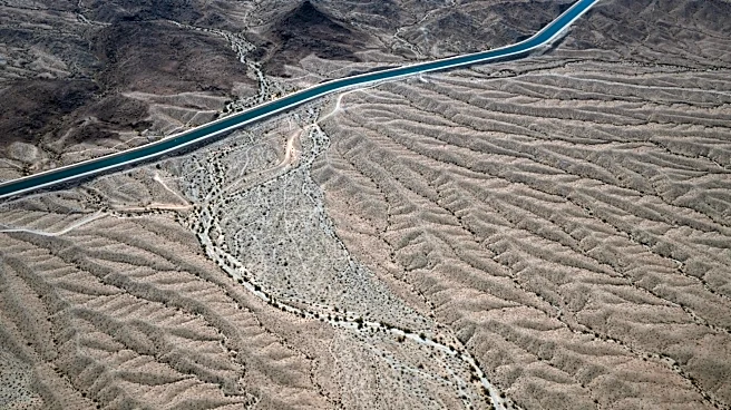
studied globally. These inaccuracies are especially prevalent in waterways heavily influenced by human factors like dams and reservoirs. Colin Gleason, a professor at UMass Amherst who led the research, noted discrepancies where satellite observations showed rivers deepening while models predicted them becoming shallower. The study, published in Geophysical Research Letters, highlights that these models often fail to account for complex factors such as economics, policy, history, and environmental regulations that dictate reservoir operations. This issue is particularly critical in the Mountain West, affecting major river systems like the Columbia and Platte, which are vital for water supplies, hydropower generation, and climate change preparedness.
Why It's Important?
The identified flaws in global river models have significant implications for water management and resource allocation across the Western United States. Accurate river modeling is crucial for effective planning of water supplies, especially as climate change intensifies pressure on these resources. Errors in predicting river behavior can lead to misinformed decisions regarding water distribution, agricultural irrigation, and urban water provisions, potentially exacerbating water scarcity issues. Furthermore, the reliability of hydropower generation, a key component of the region's energy infrastructure, depends on precise river flow predictions. The study underscores the need for more sophisticated models that integrate human-influenced variables, ensuring that communities and industries can better prepare for and adapt to changing environmental conditions. The availability of free, open, and public satellite data from NASA offers an opportunity to enhance the accuracy of these models, benefiting a wide range of stakeholders from policymakers to local communities.
What's Next?
The new satellite observations are expected to prompt researchers and water managers to improve existing global river models. While specialized models for major Western rivers are generally more accurate, the NASA data can help refine broader models, especially in areas with limited direct river measurements. Colin Gleason hopes that more researchers and water managers will utilize the freely available satellite data to enhance their predictions. This integration of real-time satellite data with existing modeling frameworks could lead to more robust and reliable forecasts of river conditions. The ongoing pressure from climate change on Western water supplies makes the accuracy of these predictions increasingly vital, suggesting a future focus on interdisciplinary approaches that combine hydrological science with socio-economic and policy considerations to better manage water resources.
Beyond the Headlines
The revelation of significant discrepancies in river models extends beyond immediate water management concerns, touching upon the broader challenges of integrating complex human systems into environmental science. The need to account for 'economics, policy, history, environmental regulations' in hydrological models highlights a critical gap in traditional scientific approaches. This suggests a paradigm shift towards more holistic, interdisciplinary research that acknowledges the profound impact of human decisions on natural systems. Ethically, the reliance on flawed models could lead to inequitable water distribution or environmental damage, underscoring the responsibility of scientists and policymakers to ensure the most accurate data is used. Culturally, water in the American West is deeply intertwined with identity, history, and conflict, meaning that improved modeling could help mitigate future disputes over this precious resource and foster more sustainable practices.