


What's Happening?
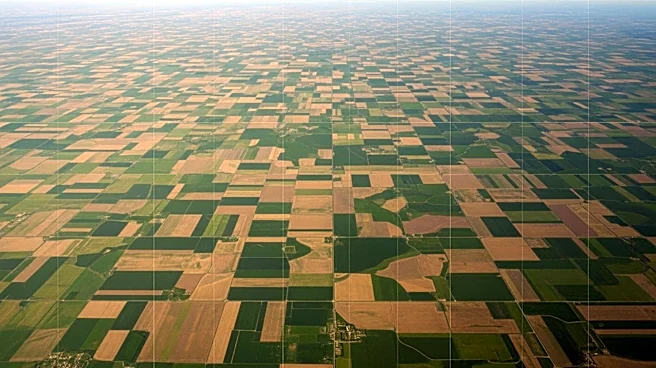
A new composite image from the NISAR satellite, a joint mission by NASA and the Indian Space Research Organisation (ISRO), reveals detailed agricultural patterns in South Africa. The image, which resembles a rainbow patchwork quilt, uses data to highlight
different crop types and land use in the region along the Vetrivier. This area is part of the Maize Triangle, a significant agricultural zone. NISAR, launched in July 2025, is designed to monitor natural disasters, ecosystems, and other Earth surface phenomena. The satellite's data provides insights into vegetation changes and land use, contributing to a better understanding of Earth's environmental dynamics.
Why It's Important?
The NISAR satellite's ability to capture detailed images of Earth's surface is crucial for monitoring environmental changes and managing agricultural resources. By providing precise data on crop types and land use, NISAR supports efforts to optimize agricultural practices and improve food security. The satellite's observations can also aid in disaster management by tracking changes in ecosystems and identifying areas at risk. This mission underscores the importance of international collaboration in addressing global challenges related to climate change and sustainable development.