


What's Happening?
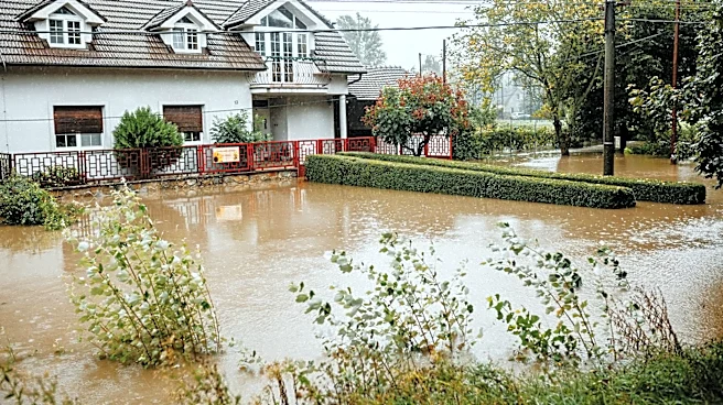
Denver experienced severe storms on Monday, resulting in rainfall exceeding the typical monthly average for June in just a few hours. The National Weather Service issued multiple urgent weather warnings, including flash flood and tornado warnings, as the storms created
immediate hazards across the metro area. The intense rainfall, measured at 2.28 inches in some areas, led to flash flooding and potential tornado development. The timing of the storms during peak daytime activity increased the risk for commuters and residents, with saturated ground raising concerns about dangerous runoff in urban areas.
Why It's Important?
The severe weather event in Denver highlights the increasing frequency and intensity of extreme weather patterns, which can have significant impacts on urban infrastructure and public safety. The rapid onset of such storms poses challenges for emergency response and preparedness, emphasizing the need for robust weather monitoring and communication systems. The event also underscores the importance of climate resilience planning in urban areas, as cities must adapt to changing weather patterns to protect residents and infrastructure. The economic and social implications of such events are considerable, affecting transportation, property, and public services.
What's Next?
Meteorologists caution that conditions remain volatile, with ongoing risks of large hail, gusty winds, and isolated flash flooding. The storm system is expected to move eastward, impacting eastern Colorado before reaching Kansas and Nebraska. Authorities continue to monitor the situation, urging residents to stay informed and take precautions. The event may prompt further discussions on climate adaptation strategies and the need for investment in infrastructure to withstand extreme weather events.