
What's Happening?
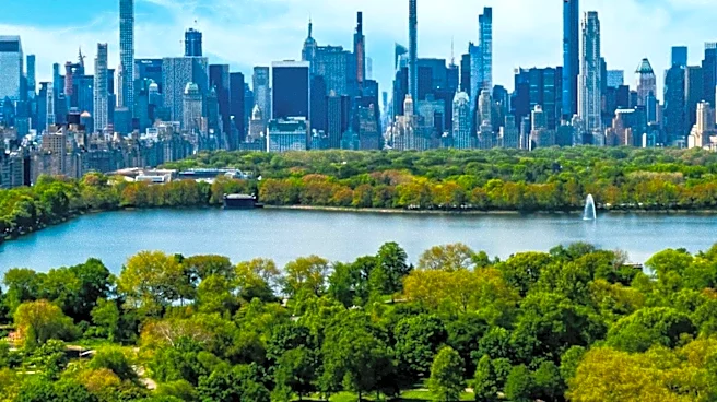
Researchers from Cornell University have developed a comprehensive, 'wall-to-wall' map identifying 1.8 million individual trees across New York City. This innovative approach, detailed in a study published
in Scientific Data, utilizes satellite imagery, on-the-ground datasets, and 3D lidar data to identify tree types with 82% accuracy. The map includes trees on private property, in natural areas, and other previously unsurveyed locations, which account for an estimated 65% of the city's tree canopy. This project, part of the Cool Trees initiative led by Dr. Arnab Ghosh, aims to optimize tree placement for urban cooling, a critical need as New York City experiences more frequent and intense heat waves. The data will inform decisions on which tree types are most effective for cooling, reducing allergens, and managing invasive pests.
Why It's Important?
This research holds significant importance for U.S. cities, particularly those grappling with the urban heat island effect and the increasing frequency of heat waves. By providing a detailed inventory of New York City's trees, the project offers a powerful tool for urban planners and policymakers to strategically expand tree cover. The city has a goal to increase tree cover from 22% to 30% by 2040, and this map can directly inform those efforts. Optimizing tree placement can lead to tangible public health benefits by reducing heat-related illnesses and emergency room visits, as highlighted by Daniel Katz, a senior author and assistant professor. Economically, effective urban forestry can lower energy consumption for cooling and enhance property values, benefiting residents and local economies. The methodology developed could be scaled to 405 other medium and large U.S. cities, offering a nationwide solution to urban heat mitigation.
What's Next?
The research team plans to use the new map to further analyze the relationship between tree density, tree type, temperature, and heat-related health risks. This ongoing analysis will provide actionable insights for urban forestry initiatives. The data will be made publicly available and user-friendly, encouraging planners, researchers, and the public to utilize it for various purposes, including neighborhood-level planning. The success of this approach in New York City paves the way for its application in other U.S. cities, with the team having already compiled a database of 405 potential locations. Future steps include developing predictive models that can quantify the impact of specific planting and management decisions on temperature reduction and public health outcomes, such as emergency room visits during heat waves.
Beyond the Headlines
Beyond its immediate practical applications, this project highlights the growing intersection of environmental science, public health, and urban planning. The use of advanced satellite and lidar technology for detailed ecological mapping represents a significant technological leap in urban environmental management. This initiative also underscores the ethical responsibility of cities to protect vulnerable populations from the impacts of climate change, particularly heat-related health risks that disproportionately affect low-income communities. Culturally, the project could foster a greater appreciation for urban green spaces and encourage community involvement in tree planting and maintenance efforts. The 'wall-to-wall' mapping approach sets a new standard for understanding and managing urban ecosystems, potentially influencing how cities worldwide approach climate resilience and sustainable development.