
What's Happening?
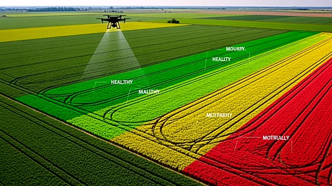
Drone multispectral terrain mapping is transforming precision agriculture by providing farmers with advanced tools for crop monitoring and resource management. This technology allows drones to survey large
agricultural areas quickly, identifying issues such as leaks, pests, and crop health variations that would take much longer to detect manually. The global agricultural drone market is projected to reach $6.4 billion by 2027, underscoring the growing importance of aerial inspection services. Drones equipped with multispectral cameras can detect plant stress and other issues before they become visible, enabling early interventions and optimizing yields. This shift from traditional manual inspections to data-driven approaches is enhancing efficiency and reducing operational risks for farmers.
Why It's Important?
The adoption of drone technology in agriculture is crucial for improving efficiency and sustainability. By providing precise data on crop health and environmental conditions, drones help farmers make informed decisions, reducing the need for excessive chemical use and water consumption. This not only lowers costs but also minimizes the environmental impact of farming practices. The technology supports the broader trend towards precision agriculture, which aims to increase productivity while conserving resources. As the agricultural sector faces challenges such as climate change and resource scarcity, innovations like drone mapping are essential for ensuring food security and sustainable farming practices.