








What's Happening?
A severe thunderstorm watch has been issued for the majority of Maryland, including the Baltimore-Washington region, effective until 8 p.m. Friday. The National Weather Service (NWS) indicates that damaging winds are the primary threat associated with
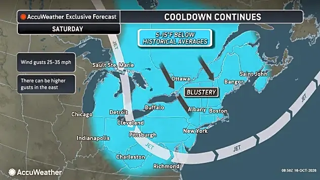
these storms, with a brief tornado also being a possibility. Affected counties include Baltimore, Anne Arundel, Howard, Montgomery, Prince Georges, Carroll, Fredrick, Washington, Cecil, Harford, Calvert, Charles, St. Mary's, Allegany, and Garrett. Temperatures are projected to reach 84 degrees Fahrenheit on Friday before the thunderstorms arrive after 5 p.m. The chance of rain is expected to increase from 30% in the afternoon to 80% overnight, with temperatures dropping to around 49 degrees Fahrenheit. Following the storms, a gale warning will be in effect for parts of the Chesapeake Bay from Saturday morning to Sunday morning. Additionally, frost and localized freezing conditions are anticipated west of Interstate 95 on Saturday night into Sunday morning.
Why It's Important?
This severe weather alert is important for residents and businesses across a significant portion of Maryland, as it signals potential disruptions and safety concerns. Damaging winds can lead to power outages, property damage, and hazardous driving conditions, impacting daily commutes and commercial operations. The possibility of a brief tornado, while less common, poses a severe threat to life and infrastructure. The gale warning for the Chesapeake Bay will affect maritime activities, including commercial shipping and recreational boating, potentially leading to delays or cancellations. Furthermore, the anticipated drop in temperatures and the risk of frost and freezing conditions could impact agriculture and outdoor infrastructure, particularly in areas west of Interstate 95. The combination of these weather phenomena necessitates heightened awareness and preparedness for a broad range of stakeholders in the region.
What's Next?
Residents in the affected Maryland counties are advised to remain vigilant and follow weather updates from the National Weather Service. The severe thunderstorm watch is in effect until 8 p.m. Friday, and conditions are expected to change rapidly. Following the immediate threat of thunderstorms, a gale warning will be active for portions of the Chesapeake Bay from Saturday morning to Sunday morning, requiring caution for those involved in marine activities. Additionally, the forecast indicates a risk of frost and localized freezing conditions west of Interstate 95 on Saturday night into Sunday morning, which could impact outdoor plants and require protective measures. The weather is expected to gradually clear, with sunny skies returning on Saturday and continuing into next week, with temperatures climbing into the mid-to-upper 60s by Tuesday. Local authorities will likely provide further guidance on safety measures and any potential storm-related impacts.
Beyond the Headlines
The issuance of a severe thunderstorm watch across a large, densely populated region like the Baltimore-Washington area highlights the increasing frequency and intensity of extreme weather events in the United States. While this specific event is localized, it contributes to a broader pattern of weather volatility that has significant long-term implications for urban planning, infrastructure resilience, and emergency preparedness. The combination of high temperatures preceding severe storms is a common characteristic of such events, underscoring the complex interplay of atmospheric conditions. For local governments and utility companies, these events test the robustness of their emergency response systems and infrastructure. For residents, it reinforces the importance of having emergency plans, including provisions for power outages and potential evacuations. The economic impact can extend beyond immediate damage, affecting local businesses through closures and reduced consumer activity, and potentially increasing insurance claims across the region.