


What's Happening?
A developing storm system in the Gulf of Mexico is set to bring heavy rainfall and potential flooding to the Gulf Coast, particularly affecting Louisiana, Mississippi, and Alabama. The storm, which is not expected to develop into a tropical depression
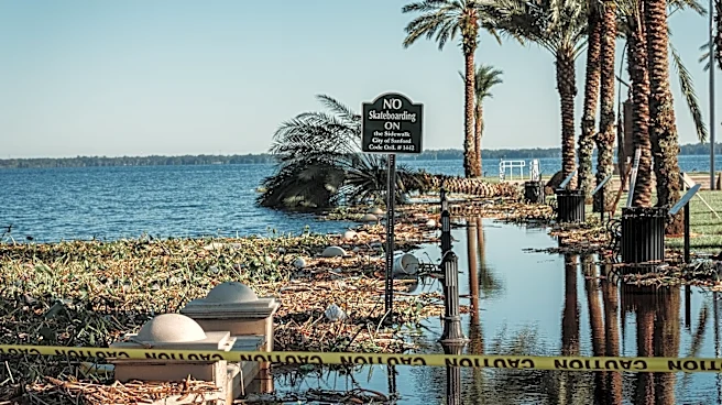
or storm, will bring deep tropical moisture, leading to coastal flooding, rough surf, and rip currents. The National Oceanic and Atmospheric Administration (NOAA) has issued a Level 1 flash flood threat for the region through Sunday. The New Orleans, Biloxi, and Gulfport metro areas are expected to experience the heaviest rainfall, with potential for more than 3 inches of rain if multiple storms track over the same area. Coastal Flood Advisories have been issued, warning of 1 to 2 feet of total water rise, which could flood low-lying areas.
Why It's Important?
The impending weather conditions pose significant risks to the Gulf Coast, a region already vulnerable to flooding due to its low-lying geography. The heavy rainfall and potential flooding could disrupt daily life, damage property, and impact local economies, particularly in areas dependent on tourism and fishing. The storm's impact on infrastructure, such as roads and bridges, could also pose challenges for emergency services and residents. Additionally, the threat of rip currents and rough surf presents a danger to beachgoers and could lead to beach closures, affecting local businesses reliant on tourism.
What's Next?
As the storm system moves inland, it is expected to combine with an upper-level disturbance, triggering thunderstorms across the Lower and Mid-Mississippi valleys. This could expand the flood risk into the Plains and Midwest over the weekend. Local authorities and emergency services are likely to monitor the situation closely, issuing further advisories and warnings as necessary. Residents in affected areas are advised to stay informed and take precautions to protect themselves and their property from potential flooding and severe weather conditions.