

What's Happening?
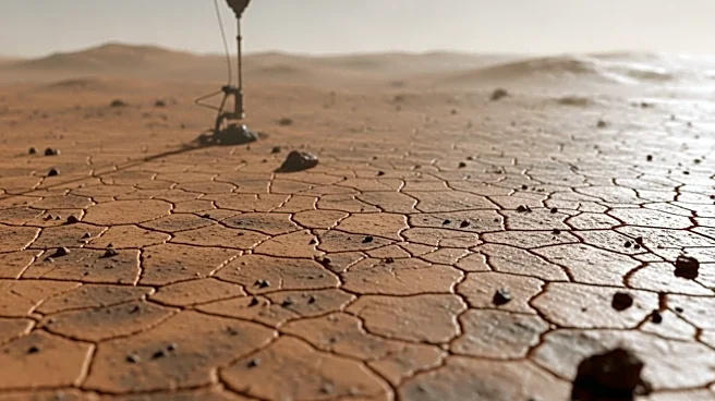
NASA's Curiosity rover encountered delays in data transmission while exploring a terrain characterized by polygonal textures beyond the boxwork area. The geology team creatively planned observations without knowing the rover's exact location, utilizing
AEGIS for autonomous target selection. Despite initial challenges, data arrived in time for subsequent planning, allowing detailed study of the polygonal blocks. The rover conducted multiple ChemCam and APXS observations to understand the formation and environmental conditions of the polygons. Atmospheric and environmental monitoring continued, including dust-devil searches and subsurface water analysis.
Why It's Important?
Understanding the formation of polygonal textures on Mars is vital for reconstructing the planet's geological and environmental history. These features may reveal information about past climate conditions and surface processes. The ability to adapt to data delays demonstrates the resilience and ingenuity of the mission team, ensuring continued scientific progress. Insights gained from these observations contribute to the broader goals of Mars exploration, including the search for habitable conditions and preparation for future human missions.