





What's Happening?
A new deep learning framework, co-developed by researchers from the National University of Singapore (NUS) College of Design and Engineering (CDE) and Tsinghua University School of Architecture, has revealed that approximately 11 million Americans and 4.1
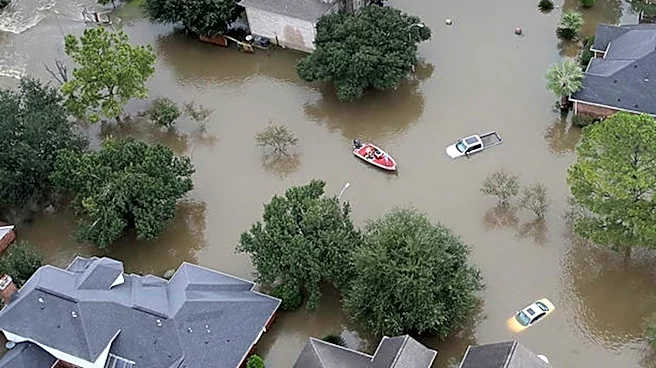
million buildings may be omitted from official flood risk maps across the contiguous United States. Published in Nature Communications, this AI-generated 30-meter flood hazard map provides a more comprehensive view of flood exposure by learning from existing official flood records and terrain data. The study indicates that the actual flood risk across the U.S. is substantially greater than currently recognized. These omissions are not uniformly distributed, with many under-mapped and unmapped areas disproportionately affecting socially vulnerable populations, including the elderly and children. The AI model functions as a validation and correction system, leveraging current topographical data to produce more consistent and accurate flood maps, even in areas lacking official assessments.
Why It's Important?
The revelation that millions of Americans and buildings are not included in official flood risk zones has significant implications for disaster preparedness, insurance decisions, and urban planning in the U.S. Underestimated flood risks can leave communities unaware of potential dangers, hindering their ability to prepare for future flood events. This oversight can lead to inadequate infrastructure development, insufficient emergency response planning, and a lack of appropriate insurance coverage, leaving individuals and municipalities financially vulnerable. The disproportionate impact on socially vulnerable populations highlights an environmental justice issue, suggesting that those least equipped to recover from disasters are often the most exposed to unacknowledged risks. This study underscores the critical need for updated and comprehensive flood mapping to ensure equitable resource allocation and effective resilience planning across the nation.
What's Next?
The findings from this AI-generated flood map are expected to prompt a re-evaluation of current flood risk assessment methodologies and official mapping efforts in the United States. While the researchers emphasize that the AI maps are not intended to replace regulatory maps, they can serve as a crucial public guide to highlight overlooked risks. This could lead to increased pressure on federal agencies, such as FEMA, to update and expand their flood insurance rate maps (FIRMs) to incorporate more accurate and comprehensive data. Policymakers may consider new legislation or funding initiatives to support the adoption of advanced AI and data analytics in flood risk management. Furthermore, communities identified as having previously unrecognized flood risks may initiate local planning efforts, public awareness campaigns, and infrastructure projects to mitigate potential damages and protect vulnerable populations.
Beyond the Headlines
This development extends beyond immediate flood risk management, touching upon broader themes of data equity, technological integration in public policy, and the evolving role of artificial intelligence in addressing societal challenges. The fact that vulnerable populations are disproportionately affected by under-mapped flood zones highlights systemic inequalities in access to critical information and protective resources. The study demonstrates AI's potential to not only identify existing gaps but also to provide more accurate and consistent data, thereby fostering more equitable and effective policy interventions. This could set a precedent for using AI in other areas of environmental risk assessment, such as wildfire or earthquake preparedness, leading to a more proactive and data-driven approach to national resilience. It also raises ethical considerations regarding data privacy and the responsible deployment of AI in sensitive public safety contexts.