






What's Happening?
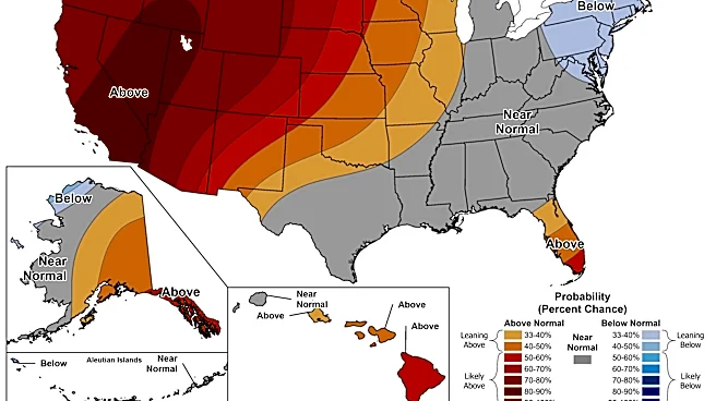
The Central Coast of California is currently experiencing an extended and intensifying heat wave, with a Heat Advisory now prolonged through 10 p.m. Wednesday for interior portions of the Bay Area and Central Coast. Saturday marked an 'Impact Day' as temperatures
significantly rose, with some areas like Salinas seeing a 30-degree increase in just four hours due to offshore winds. While a layer of morning low clouds and fog briefly covered parts of the coastline, it quickly dissipated, allowing temperatures to soar. The hot weather pattern is expected to persist into the work week, with inland areas facing the most consistent and intense heat. Even coastal communities, generally cooler, could see rising temperatures, posing potential dangers from prolonged heat exposure. Residents are advised to take precautions, especially during peak afternoon temperatures.
Why It's Important?
This prolonged heat wave carries significant implications for public health, local economies, and infrastructure across the Central Coast. The elevated temperatures increase the risk of heat-related illnesses, particularly for vulnerable populations such as children, older adults, and those without access to air conditioning. The strain on the power grid could lead to increased energy consumption and potential blackouts, impacting businesses and daily life. Agricultural sectors, a cornerstone of the Central Coast's economy, may face challenges with crop stress and increased irrigation demands. Furthermore, the extended heat can exacerbate drought conditions and elevate wildfire risks, threatening natural landscapes and communities. The need for residents to stay hydrated, seek shade, and avoid leaving individuals or pets in vehicles underscores the immediate public safety concerns.
What's Next?
The Heat Advisory is set to continue through Wednesday night, with the possibility of expansion to additional areas if temperatures exceed current expectations. Residents are urged to maintain heat safety practices, including drinking plenty of water, taking breaks from the heat, and seeking air-conditioned environments. Authorities will likely continue to monitor weather conditions closely and issue further advisories or warnings as needed. Looking ahead, weather models indicate a potential pattern change late next week and into the following weekend, which could bring cooler temperatures closer to typical October levels. This shift would offer relief to both coastal and inland regions, but until then, the focus remains on managing the current heat wave and its immediate impacts.
Beyond the Headlines
Beyond the immediate concerns of public health and energy consumption, this heat wave highlights broader issues related to climate patterns and urban planning in the Central Coast. The increasing frequency and intensity of such events underscore the need for long-term strategies to adapt to changing climate conditions, including investments in resilient infrastructure and public cooling centers. It also brings to light socio-economic disparities, as access to adequate cooling and resources for heat mitigation varies across communities. The impact on local ecosystems, including water resources and biodiversity, could also be significant, potentially leading to long-term environmental shifts. This event serves as a reminder of the interconnectedness of environmental factors, public health, and economic stability in the region.