


What's Happening?
The U.S. Naval Research Laboratory (NRL) in Monterey, California, has completed the first field campaign of the Injected Smoke and PYRocumulonimbus Experiment (INSPYRE). This mission, led by principal investigator David Peterson, Ph.D., a research meteorologist
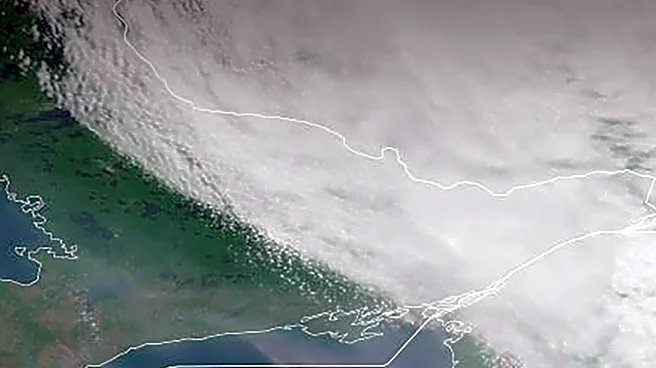
at NRL, focused on understanding how wildfire smoke enters and moves through the upper atmosphere. During the campaign, an NRL-led team used scientific aircraft to intercept a smoke plume originating from Siberia, which had traveled thousands of miles across the Arctic, Alaska, and the North Pacific. The team collected direct measurements of smoke carried high into the atmosphere over three consecutive days. The INSPYRE campaign, which lasted three months, studied pyrocumulonimbus (pyroCb) clouds, or fire-generated thunderstorms, which can significantly impact weather forecasting and fire behavior. The mission utilized NASA’s ER-2 aircraft for high-altitude observations and the U.S. National Science Foundation/National Center for Atmospheric Research Gulfstream V (GV) for direct sampling within pyroCb plumes. These observations provide a rare, multi-perspective view of smoke events, from near the source to inside the plume and from space, allowing researchers to connect initial fire events with distant atmospheric measurements.
Why It's Important?
This research is crucial for addressing a significant gap in atmospheric forecasting: accurately predicting the travel path, altitude, and atmospheric impact of wildfire smoke plumes. Current satellite imagery provides some data, but it requires assumptions about particle size and how particles interact with sunlight, which affects the plume's overall atmospheric impact. By replacing these assumptions with comprehensive direct measurements, the INSPYRE campaign aims to improve the accuracy of atmospheric models. For the U.S. Navy, understanding the location, altitude, and particle properties of large smoke plumes is vital for visibility, aviation, and the performance of optical systems, such as lasers, satellite communication, and targeting cameras, which can be degraded by smoke. The findings will also enhance understanding of how quickly conditions can change near fires, as fire-generated clouds can rapidly propel smoke into the stratosphere, impacting weather patterns and air quality over vast regions. Improved forecasting capabilities will benefit various sectors, including aviation, defense, and public health, by providing more accurate predictions of smoke dispersion and its effects.
What's Next?
Following the completion of the field campaign, instrument teams are now engaged in checking and processing the collected data. Research groups will analyze fire behavior, cloud development, and transported smoke. This analysis phase is critical for determining which observations can effectively improve existing atmospheric models and identifying areas where current forecasts diverge from reality. The ultimate goal is to translate the campaign’s measurements into practical tools that can support operational decisions for forecasters and relevant agencies. The INSPYRE team is also preparing for a second deployment scheduled for 2027, indicating a continued commitment to this research. This ongoing effort aims to build upon the initial findings, further refine atmospheric models, and develop more robust forecasting applications for wildfire smoke and its atmospheric impacts. Collaboration with NASA, NSF, NCAR, and NOAA will continue to be essential in advancing this scientific understanding and its practical applications.
Beyond the Headlines
The INSPYRE campaign highlights the increasing complexity and global reach of environmental phenomena like wildfires. The study of smoke plumes traveling thousands of miles underscores the interconnectedness of global atmospheric systems and the transboundary nature of environmental challenges. The research also touches upon the ethical implications of climate change, as more intense and frequent wildfires contribute to these large-scale smoke events. From a scientific perspective, the project pushes the boundaries of atmospheric science by integrating advanced airborne measurements with satellite observations, leading to a more holistic understanding of pyroconvection. The long-term shifts triggered by this development could include more sophisticated early warning systems for air quality, improved aviation safety protocols in smoke-affected regions, and a deeper scientific basis for climate modeling that incorporates the effects of wildfire emissions. This research also emphasizes the critical role of inter-agency collaboration in tackling complex environmental issues that have far-reaching societal and economic consequences.