


What's Happening?
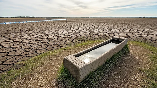
A Super El Niño is anticipated to develop in the Pacific Ocean, potentially leading to significant changes in global weather patterns. This climate phenomenon, characterized by unusually warm ocean temperatures, is expected to intensify by late summer
or early fall. The Super El Niño could bring extreme weather events, such as flooding, droughts, and heatwaves, affecting various regions worldwide. In the U.S., it may result in increased winter storms along the West Coast and heightened risks of flooding. The phenomenon is also likely to accelerate global warming by releasing stored ocean heat into the atmosphere, potentially setting new records for the warmest years.
Why It's Important?
The development of a Super El Niño is crucial due to its potential to exacerbate extreme weather events and impact global climate patterns. Such events can cause billions of dollars in damages, affecting agriculture, infrastructure, and public safety. In the U.S., the anticipated increase in winter storms and flooding could strain emergency services and infrastructure, while globally, regions prone to drought and heatwaves may face heightened risks. The acceleration of global warming due to El Niño's heat release could further challenge efforts to mitigate climate change impacts, emphasizing the need for adaptive strategies and international cooperation.
What's Next?
Meteorologists will closely monitor the development of the Super El Niño, with forecasts expected to become more accurate as the phenomenon progresses. Governments and organizations worldwide may need to prepare for potential impacts, including implementing emergency response plans and adapting infrastructure to withstand extreme weather. The scientific community will continue to study El Niño's effects on global climate systems, providing valuable insights for future climate predictions and policy-making. Public awareness campaigns may also be necessary to inform communities about the potential risks and encourage preparedness.