
What's Happening?
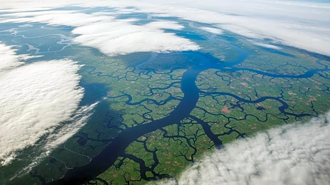
NASA's Terra satellite has captured a striking image of the Ganga Delta covered in dense fog on January 6, 2026. The image, taken by the Moderate Resolution Imaging Spectroradiometer (MODIS), shows low-lying
clouds across the Indo-Gangetic Plain, which includes regions of Pakistan, India, and Bangladesh. The fog is a result of a cold wave affecting the area, leading to warnings of moderate to very dense fog. Such weather conditions are common during this time of year and can cause significant disruptions to transportation and daily life in the region.
Why It's Important?
The dense fog over the Ganga Delta highlights the impact of seasonal weather patterns on transportation and infrastructure in the region. Such conditions can lead to delays and disruptions, affecting economic activities and daily life. The ability to monitor and predict these weather patterns is crucial for mitigating their effects and ensuring safety. This event also underscores the importance of satellite technology in providing real-time data for weather forecasting and disaster management, which can help in planning and response efforts.