


What's Happening?
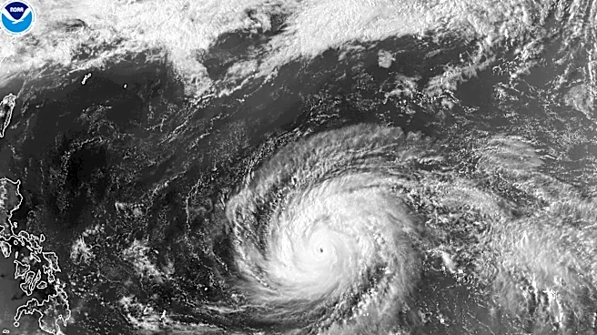
Super Typhoon Sinlaku, a powerful storm, is currently impacting the Mariana Islands in the North Pacific Ocean. Captured by the VIIRS on the Suomi NPP satellite, the typhoon reached sustained winds of 175 miles per hour, classifying it as a category 5 storm on the Saffir-Simpson
scale. The storm is notable for its early occurrence in the year and is one of the few category 5 typhoons recorded so early. As of April 14, 2026, Sinlaku's storm bands have begun affecting the islands of Saipan, Tinian, and Rota, with forecasts predicting typhoon conditions to persist until April 15. The storm has also generated gravity waves visible in the mesosphere, captured by the NOAA-20 satellite.
Why It's Important?
The emergence of Super Typhoon Sinlaku highlights the increasing frequency and intensity of extreme weather events, which can have devastating impacts on affected regions. The storm poses significant risks to the Mariana Islands, including potential damage to infrastructure, disruption of daily life, and threats to public safety. The early occurrence of such a powerful typhoon raises concerns about climate patterns and the potential for more frequent severe weather events. This situation underscores the importance of preparedness and resilience in vulnerable regions, as well as the need for continued research and monitoring of climate and weather phenomena.