


What's Happening?
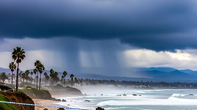
Southern California is experiencing cooler and cloudy weather conditions due to a low-pressure system moving through the northern region. According to meteorologist Paul Deanno, these conditions are expected to persist, with temperatures remaining lower
than usual. However, a shift is anticipated as offshore winds are set to return by Thursday, bringing warmer temperatures that could reach the 80s for a few days. This weather pattern is typical for the region during this time of year, as fluctuations between cooler and warmer conditions are common.
Why It's Important?
Weather patterns in Southern California have significant implications for various sectors, including agriculture, tourism, and energy consumption. Cooler temperatures can affect crop growth and yield, while warmer conditions may increase water demand and energy usage for cooling. The return of offshore winds and warmer temperatures could also elevate the risk of wildfires, a persistent concern in the region. Understanding and predicting these weather changes is crucial for local authorities and residents to prepare and mitigate potential impacts. Accurate weather forecasts help in planning and resource management, ensuring safety and efficiency.
What's Next?
As the low-pressure system moves out and offshore winds return, residents and businesses in Southern California should prepare for a brief period of warmer weather. Local authorities may issue advisories related to fire risks, given the potential for increased temperatures and dry conditions. Meteorologists will continue to monitor the weather patterns to provide updated forecasts and warnings as necessary. Residents are advised to stay informed about weather changes and take appropriate measures to protect themselves and their properties.